


 The Celtic Cycling Circle
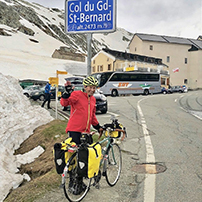 Cycling alongside the Grand Union Canal
 5 Essential Items to Take with You on Your First Cycling Tour
 Favorite Cycling Destinations: Sardinia
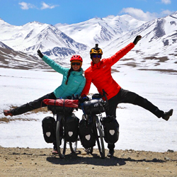 Pamir to Karakoram- cycling the highways on the roof of the world
 4 Wheels 2 Hearts 1 World - A Day in Our lives
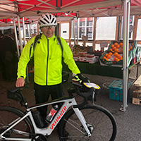
 Koga E-Worldtraveller - e-bike review
 Ten tips for tandem cycle touring
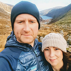 colmandsamstreks - Two Beginners in France
Orkney 2013 - The 'Island Hopping' Tour
Part 1 - Stromness to Sanday
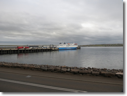
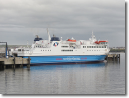
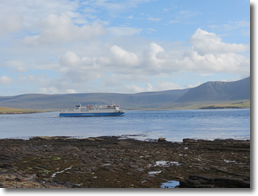
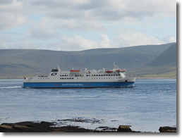
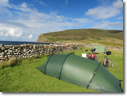
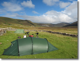
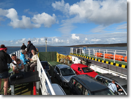
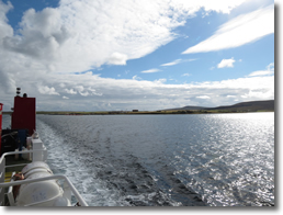
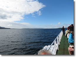
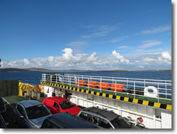
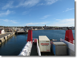
06.08.13 - Scrabster to Stromness
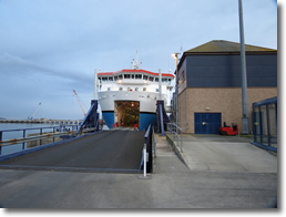
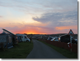
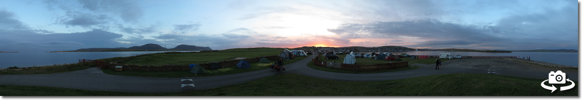
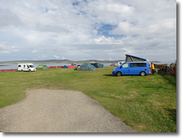
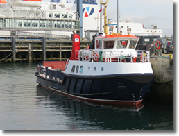
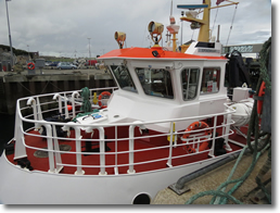
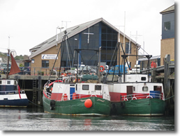
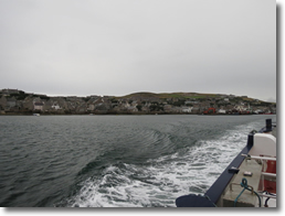
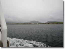
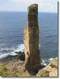
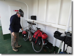
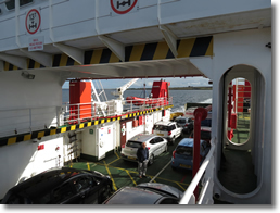
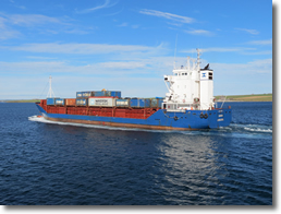
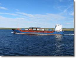
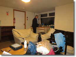
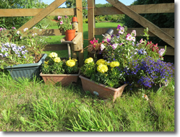
We left our car in the long-term car park at Scrabster and as we had a couple of hours to spare before the ferry left we decided to have something to eat rather than have to cook something when we got to the campsite at Stromness. Fortunately there was a Fish and Chip van near the car park so we took advantage of that. Boarding time soon came and we did a double check to make sure that we had everything from the car and headed off for the booking office to get our tickets. Although the sea looked reasonably calm there was a surprising swell, which Frank didn’t quite appreciate and she really didn't enjoy the crossing. The ferry passed quite close to Hoy and we got a good view of the Old Man of Hoy. We docked at Stromness just after 8.30 pm and as we left the ferry terminal we noticed that the Co-op was still open which was fortunate so we could get some milk and something for breakfast. Rather than trust the map we followed the campsite signs which took you up a road around the back of the town, and it was up a bit of a shock to legs that weren’t quite tuned in to pedalling a fully laden touring bike! When we got to the campsite we soon settled in pitching our tent at a vacant spot near the entrance, which looked quiet. There was a lovely sunset that evening over Stromness.
| Click on the thumbnail images below to see a larger version in a pop up window |  |
 |
 |
 |
 |
 |
 |
 |
 |
 |
|||
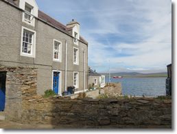
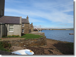
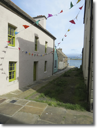
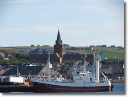
07.08.13 - Stromness
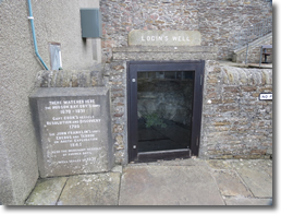
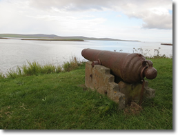
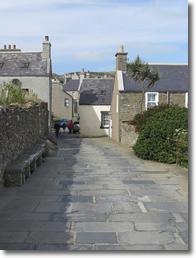
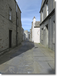
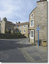
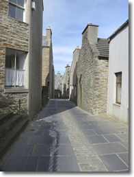
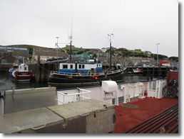
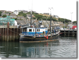
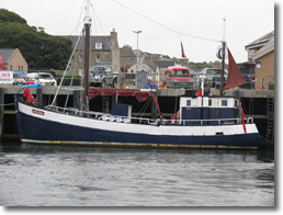
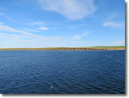
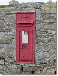
 We woke to rain but by midday the rain had cleared and the sun came out. We decided to go for a walk along the coast. As it overlooked the sound of Hoy and the entrance to Scapa Flow there were several old gun batteries and searchlight stations along the way that we could explore. It was a nice walk with good views over to Hoy. At the cemetery we turned inland and walked up on to Battery Hill which was the site of the original Ness Battery before they build the one lower down during the second world war. From Battery Hill we walked down in to have a look at the town. We could see why they directed traffic around the back of the town as the main street is narrow with a flag stone surface. There are some lovely old buildings and the whole town is rather lovely. Further along the high street we came across ‘Login's well’, which used to be used by the Hudson Bay company ships to fill their barrels for their crossings to America 1670 - 1891, Captain Cook’s vessels Resolution and Discovery in 1780 and Sir John Franklin’s ships the Erebus and Terror 1845 on their ill-fated Arctic expedition to find the North West passage.
| Click on the thumbnail images below to see a larger version in a pop up window | |
 |
 |
 |
 |
 |
 |
 |
 |
 |
 |
 |
 |
 |
 |
 |
 |
 |
 |
 |
 |
 |
 |
 |
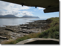
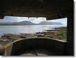
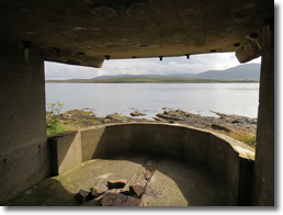
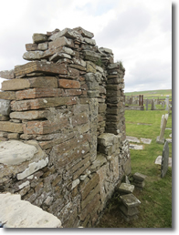
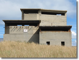
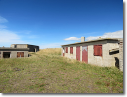
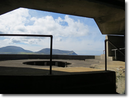
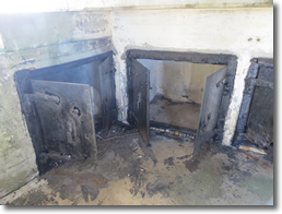
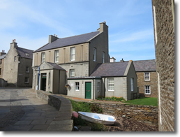
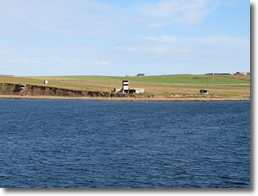
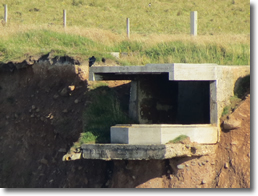
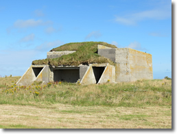
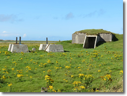
08.08.13 - Ness Battery
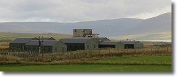
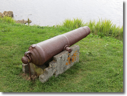
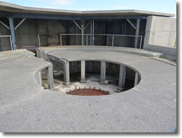
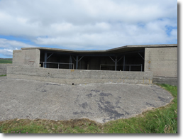
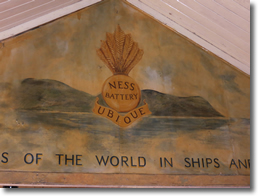
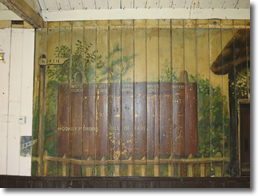
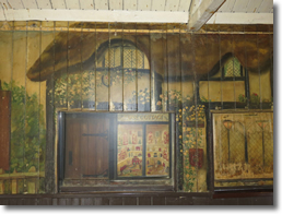
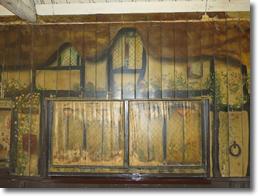
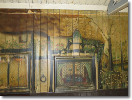
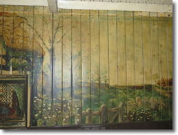
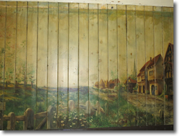
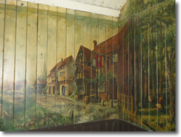
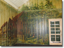
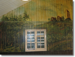
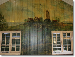
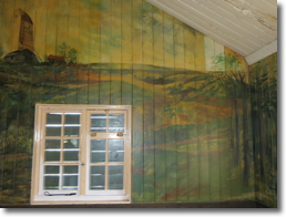
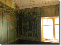
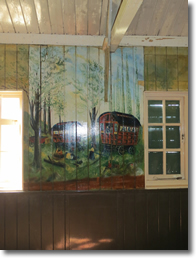
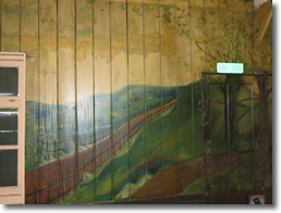
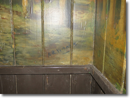
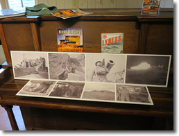
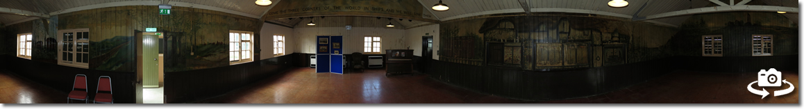
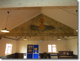
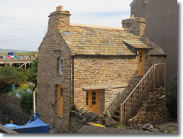
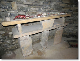
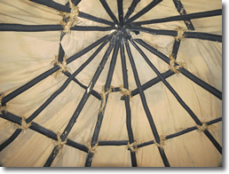
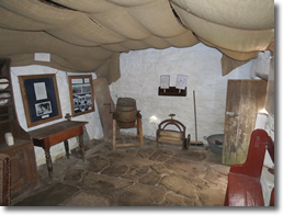
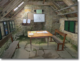
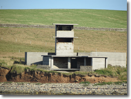
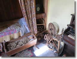
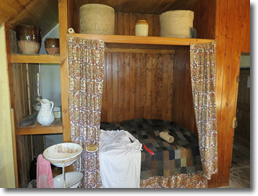
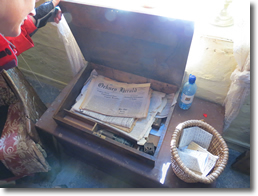
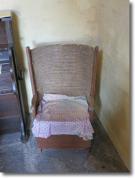
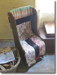
Having been past the entrance to the Ness Battery we saw on a brochure at the campsite that they did guided tours so rang up to book. We met the guide at the entrance with another couple and set off for the tour. It was really interesting to look around the old gun in placements. According to the guide they were still working on getting more of buildings checked and made surface so they could show the public more on the tour. There current project was to open up one of the underground ammunition stores. He showed us the newly made cover to the entrance but they were still working on getting electricity and lightning to it and they were hoping to have it open for summer 2014. He showed us the original barrack rooms which are a very good condition due to the fact that up until a few years ago it had been a TA centre. The most interesting part was the Mess Hall where the wooden walls had been painted with a wonderful mural depicting rural scenes painted by a AR Woods who was stationed there during the second world war. After the guided tour we headed back down to the town and had another look at the town to get some better pictures, as it was such a nice afternoon.
| Click on the thumbnail images below to see a larger version in a pop up window | |
 |
 |
 |
 |
 |
 |
 |
 |
 |
 |
 |
 |
 |
 |
 |
 |
 |
 |
 |
 |
 |
 |
 |
 |
 |
 |
 |
 |
 |
|||
 |
 |
 |
 |
 |
 |
 |
 |
 |
 |
 |
 |
 |
 |
 |
|
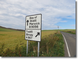
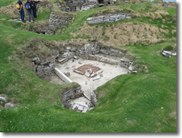
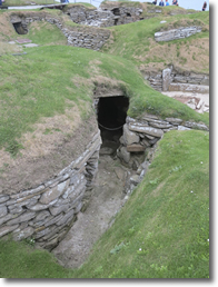
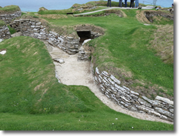
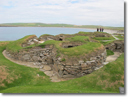
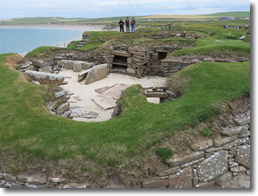
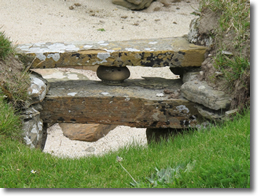
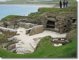
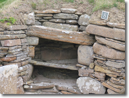
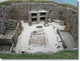
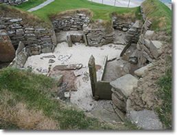
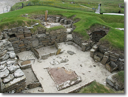
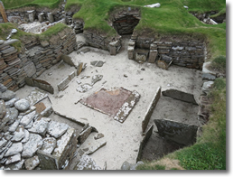
09.08.13 - Scara Brae & The Ring of Brodgar
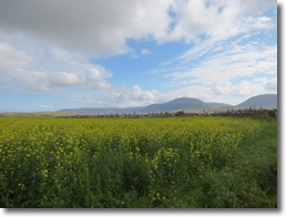
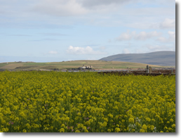
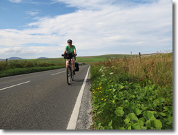
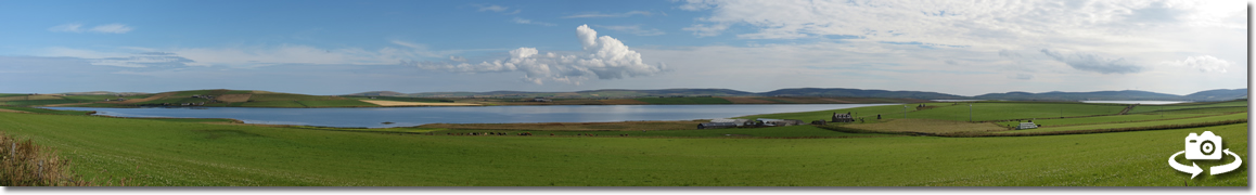
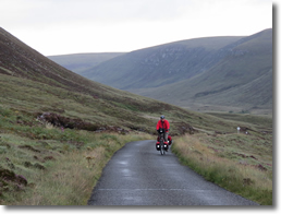
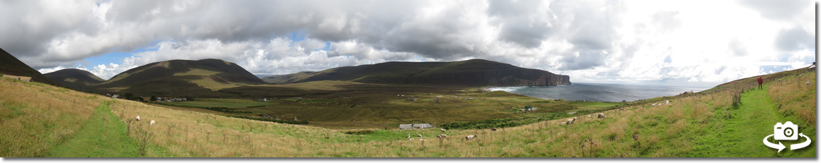
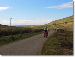
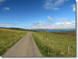
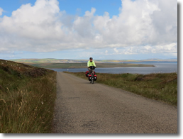
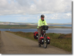
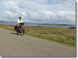
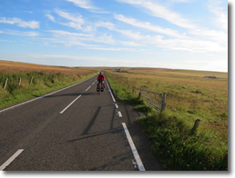
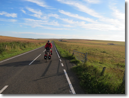
It was a lovely sunny morning and it was great to be back on our bikes. Once we had climbed up from Stromness we got some great views of Loch Harry across the hay meadows that lined the road.
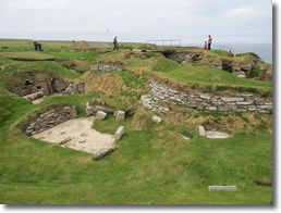
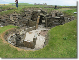
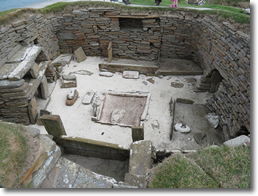
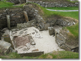
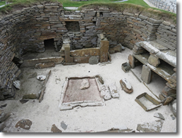
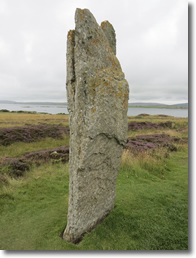
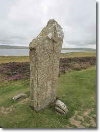
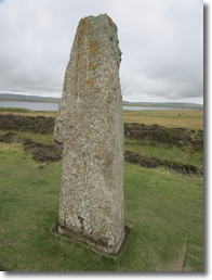
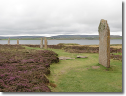
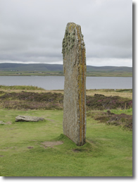
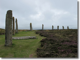
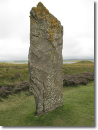
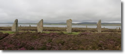
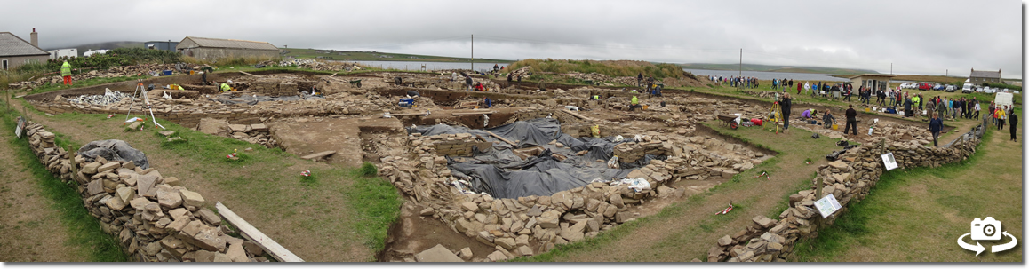
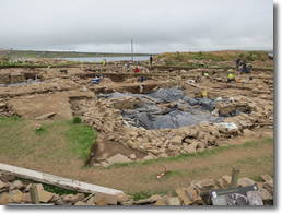
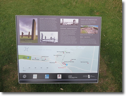
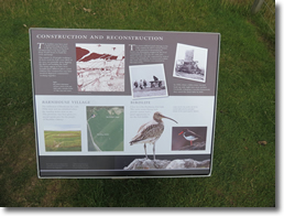
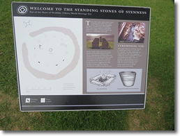
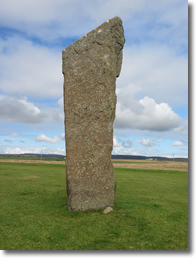
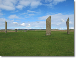
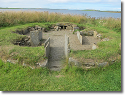
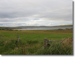
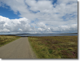
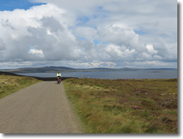
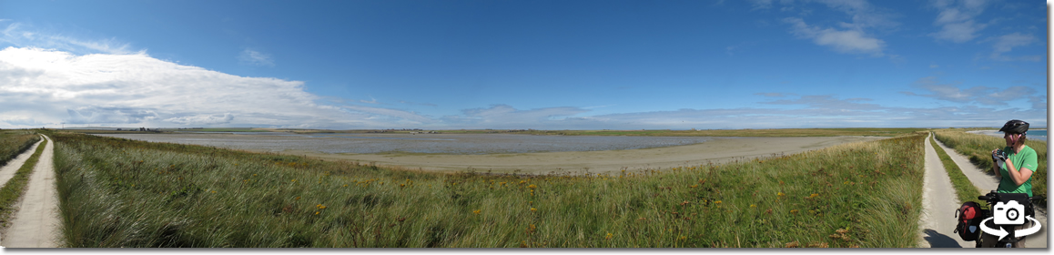
By the time we got to Scara Brae we were ready for a bit of sustenance so stopped in the cafe for a drink and a cake before walking down to look at the excavations. It was extremely interesting to see and we talked to a very informed lady warden who explained the theories of how how the village was built. She suggested that we go and have a look at the dig at the Ness of Brodgar to see what they had discovered there. Fortunately it was on our way as it was just down from the Ring of Brodgar. Just as we were leaving Scara Brae it was beginning to rain a bit so we dug out a waterproof jacket and headed off to have a look at Shield Bay before heading back down the road to the Ring of Brodgar. It was very pleasant cycling through farmland the rain hadn't come to much but the skies were still grey. It didn't take us long to get to the Ring of Brodgar and we parked the bikes and walked up to the stone circle. Originally there were 60 stones and they must have looked impressive when they were first erected as it is a large circle. Unfortunately several are missing and only 39 remain one was known to have been hit by lightning others have probably been robbed. There was a steady stream of visitors as it is obviously on the tourist coach trail and with the dull weather it wasn't easy to get any good pictures which was a shame as it has a good backdrop in Loch Hardy. From their it was a short ride down to the excavations at the Ness of Brodgar. We were a little late to get the full guided tour of the dig but we did manage to tag on to the end of the group when they got to the raised viewing platform near the road. From there you did get a good impression of the size and scale of the buildings. They were quite excited about the type and size of the buildings that they had uncovered as some of them were much bigger than the ones at Scara Brae suggesting that they may have had a ceremonial role rather than have been domestic dwellings. Just as we were leaving the site it started to rain and as we had only brought waterproof tops and it was 5.3pm we decided to leave the Stones of Stannes for tomorrow and head for home. Fortunately the rain wasn't too heavy and only our shorts got a bit wet but our tops were dry.
| Click on the thumbnail images below to see a larger version in a pop up window | |
 |
 |
 |
 |
 |
|||
 |
 |
 |
 |
 |
 |
 |
 |
 |
 |
 |
 |
 |
 |
 |
 |
 |
 |
 |
 |
 |
 |
 |
 |
 |
 |
 |
 |
 |
 |
 |
 |
 |
|||
 |
 |
||
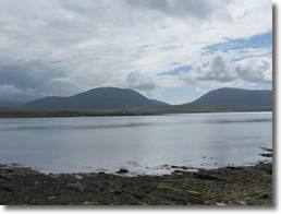
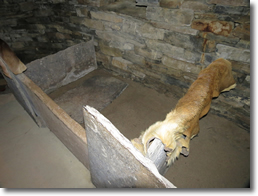
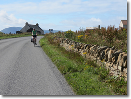
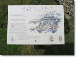
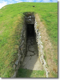
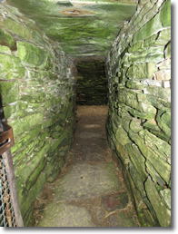
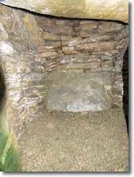
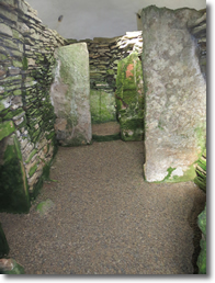
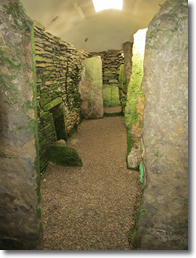
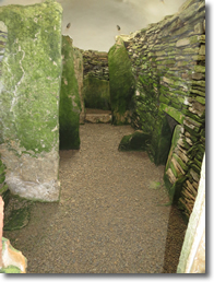
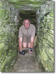
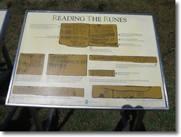
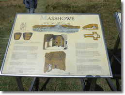
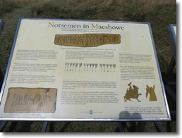
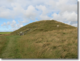
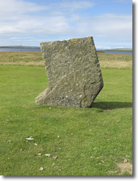
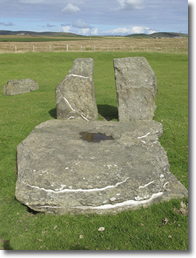
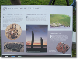
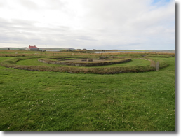
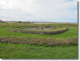
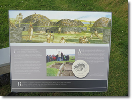
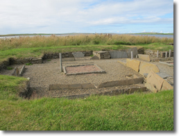
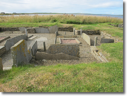
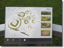
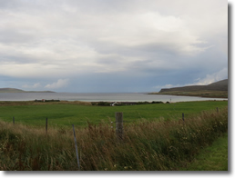
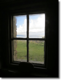
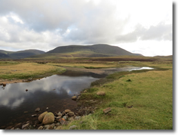
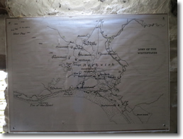
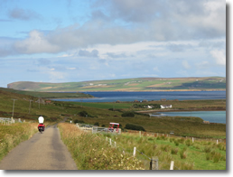
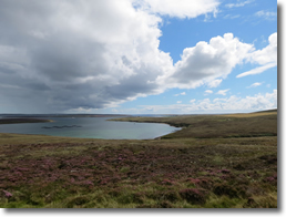
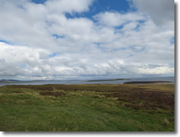
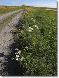
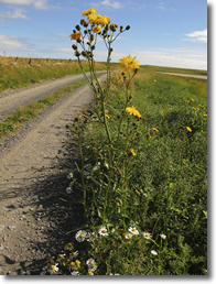
The weather was certainly a lot better than yesterday afternoon and it was quite sunny as we headed up the road to Cairston. When we topped off near the summit of Bruna Fea we got a good view of Loch Harry and the curiously named Bay of Ireland. We soon dropped down to the Bridge of Waithe and stopped shortly after to have a look at Unstan a Neolithic chambered cairn. The entrance was quite narrow and low so you had to crawl on your hands and knees to get inside. It was well preserved and had an interesting construction. From there it was a short ride up the A965 up to the visitors centre for Maeshowe at Tomiston Mill. We signed up for the guided tour of Maeshowe and It didn't cost us anything as we had our English Heritage cards with us. It was quite a low entrance and you had to stoop quite low for several feet but when you got into the main chamber you could stand up. The guide lassie was quite knowledgeable and explained about the history of Maeshowe. The inside is quite amazing as the stonework is very well put together without mortar and reminded us of the Galarus Oratory on Kerry in south west Ireland. Apparently the chambered cairn was robbed by Viking raiders who left some runic graffiti which we gather was quite rude! What was interesting was that the entrance lines up with the sunset light from the winter solstice and on the evening of the winter solstice the sun is low enough to light up the inside chamber. Unfortunately we were not allowed to take photos inside the chamber. From Maeshowe we then went round to have a better look at the Stones of Stennes as it had been throwing it down yesterday. While I taking some photos Frank was approached by a lady with a dog who asked her if we were cycling and whether they were our bikes parked at the entrance. Frank told her that we were indeed cycling and yes they were our bikes. She then asked her if we had a website, when Frank said yes she said l knew it was you! It turned out that it was Jane & Alan who were fellow cycle tourers and had been in touch with us via e-mail asking us about the Lofoten Isles. After a long chat we arranged to meet them for a meal in Stromness that evening. Close by to the Stones of Stennes is the Barnhouse Neolithic village that has been excavated and there are some interesting remains. While we were there we met a couple of American guys who were doing some pole aerial photography and I had a long chat with them as they also did kite aerial photography. As it was getting late and we had agreed to meet Jane & Allen for a meal we headed on back to Stromness to have a shower and make ourselves presentable. We had a lovely meal that evening with Jane and Alan, it was so nice to chat to kindred spirits. What was more amusing was that we found that they were from Teeside and taught in a school that I had taught at when I lived there and knew several friends of ours, what a small world!
| Click on the thumbnail images below to see a larger version in a pop up window | |
 |
 |
 |
 |
 |
 |
 |
 |
 |
 |
 |
 |
 |
 |
 |
 |
 |
 |
 |
 |
 |
 |
 |
 |
 |
 |
 |
 |
 |
 |
 |
 |
 |
 |
 |
 |
 |
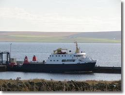
11.08.13 - Stromness to Hoy
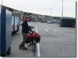
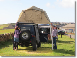
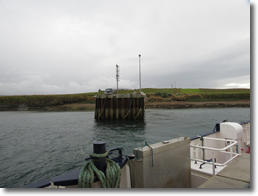
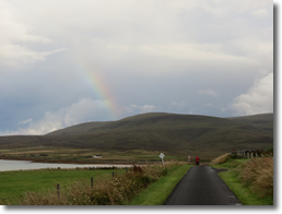
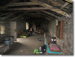
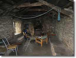
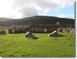
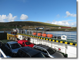
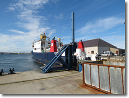
As we had changed our plans by meeting Jane and Alan for a meal last night, we had to wait again for the 6 o'clock ferry to Hoy. We decided to have a bit of a lazy day and it gave me an opportunity to sort out the petrol stove which needed a bit of a clean. Unfortunately I had spanners that fitted all the nuts on our bikes but we didn't have a 15mm spanner to fit the stove. I went to see if the campsite warden to see if he had any tools and fortunately he had a pair of grips that managed to loosen the nut and after a good clean it worked a treat. I must remember to add a 15mm spanner in the kit for next year! We popped into the Co-op on the way through to get the ferry as we knew that there were few shops on Hoy. When we got to the ferry in was a small vessel and there were several steps to get the bikes down. We took all the panniers off and the two ferry guys helped us get the bikes on board. Shortly before we were due to leave two young lads turned up with touring bikes and when they had boarded we got talking to them. They were a couple of students who had just finished doing LEJOG and were spending their last 2 weeks on Orkney and were going to camp in Rackwick Bay like us. It was interesting talking to them about LEJOG, they said it was a good experience and they had ridden through some interesting scenery but they found it wasn't that enjoyable as they felt pressured to keep going each day to get the miles in and that they were enjoying their time on Orkney as it was more relaxing. After stopping at Graemsay to drop off some people we were soon across the Burra Sound and were mooring at Moaness pier. We told the lads we would see them at the bay as we kind of guessed they would be a tad quicker than us. After stopping to pick up a quick cache soon after the pier we hit a bit of a steep hill, which fortunately didn’t go on for too, long. The road to Rackwick bay up white glen was a relatively steady climb till its summit at the car park to the Dwafie stane and from there we then had a nice ride down to Rackwick. The bothy and campsite and Burnmouth is down a wee track which had a couple of locked gates, which was a bit of a pain, as we had to lift the bikes over them. When we got to the bothy the lads were trying to get a barbeque going as they were hoping to barbecue some sausages that they had brought with them. Unfortunately most the wood that they could fine from the beach was a bit wet but they eventually they got it going only for it start raining. Just then the warden turned up and he told them if they were careful they could take into the bothy.
| Click on the thumbnail images below to see a larger version in a pop up window | |
 |
 |
 |
 |
 |
 |
 |
 |
 |
 |
 |
 |
 |
 |
 |
 |
 |
 |
 |
 |
 |
12.08.13 - Oldman of Hoy
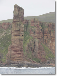
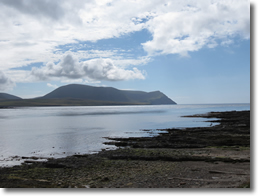
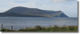
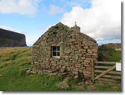
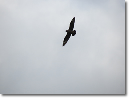
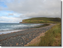
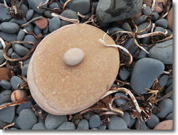
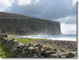
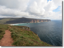
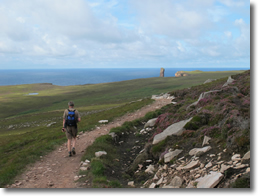
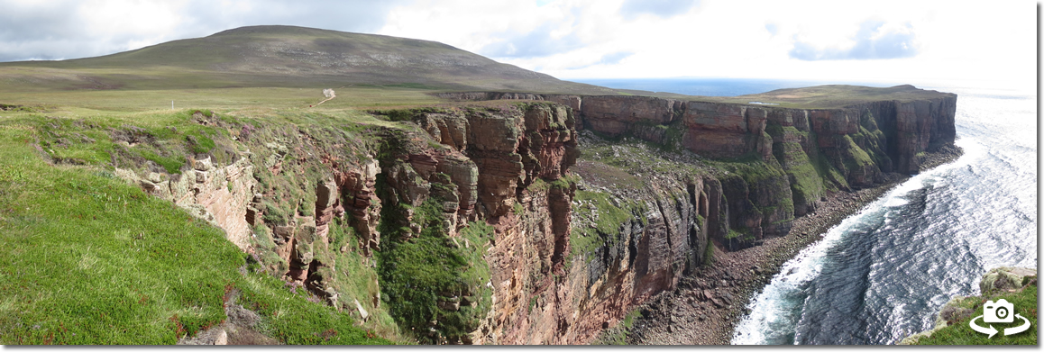
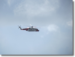
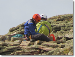
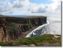
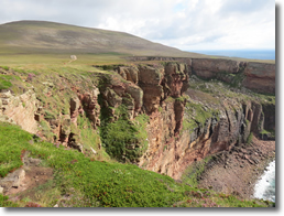
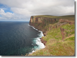
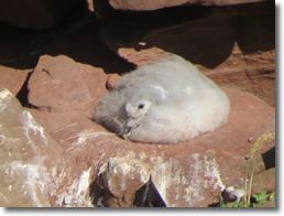
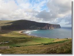
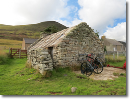
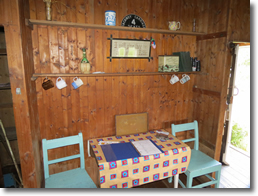
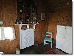
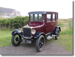
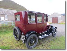
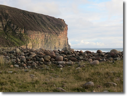
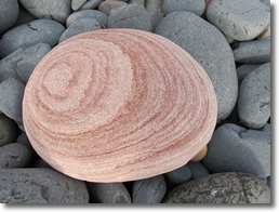
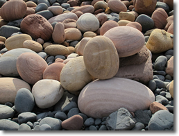
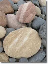
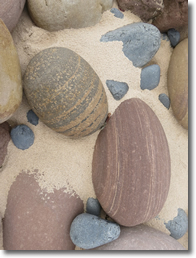
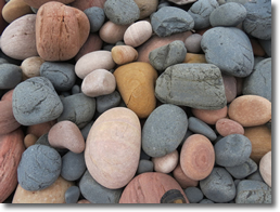
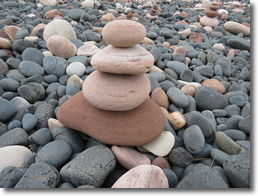
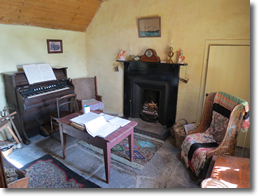
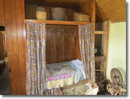
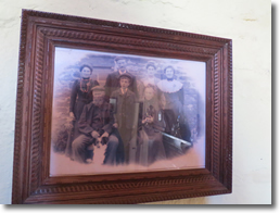
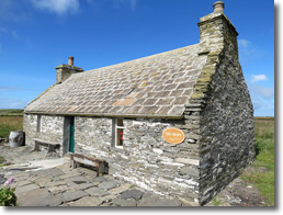
It was a lovely sunny morning and I was woken early. I left Frank sleeping and headed off for a look around the bay. It is a beautiful bay with the towering Craig-gate cliffs at the south end of the bay. There was a bit of a swell, which caused the waves to crash into the shore and created a bit of a haze above the water. I had seen a crashed airplane marked on the map in the Bothy so I headed out to have a look for it. I went quite a way through the tussock grasses and heather of the Moss of the Whitestanes behind the bothy but couldn’t see anything of the remains. I headed back to the beach and saw several Skuas hunting around for food. The beach had some wonderful coloured boulders and stones worn smooth by the pounding waves. Getting hungry I headed back to the tent to have some breakfast and a welcome cup of tea. After breakfast we packed a rucksack and headed off to have a look at the Old Man of Hoy. The path through the village is nice and grassy but as you get out on to the cliff path they have now put in a new path which currently is a bit of a scar on the landscape but hopefully given time it will grow over at the sides and mellow. From the lovely named Too of the Head we got a lovely view looking back over Rackwick Bay to towering cliffs of Craig Gate on the far side. As we got over the first rise we could see the top of the Old Man and through the binos we could see two climbers on the top. Soon after that we met a lady and her daughter coming up the path, it was her two lads who had just summited. When we got to the cliffs that overlooked the Old Man at a place called on the map ‘Tuaks of the Boy’ we sat down and watched the climbers through our binos. The stack is certainly impressive and it brought me back to being a lad and watching the live outside broadcast in 1967 of Chris Bonnington & Tom Patey recreating their first ascent of the stack that they had made the previous year, with Joe Brown & Ian McNaught-Davis and Pete Crew and Dougal Haston climbing new routes. There were several Kittiwakes nesting on the stack and I wondered what they made of the climbers. At least there didn’t seem to be any fulmars as they can projectile vomit a foul smelling fishy liquid at you! As we sat there admiring the view the coastguard helicopter came past. We headed back to Rackwick by the same path and stopped off at the local museum, which had some interesting exhibits and we both liked the wee schoolroom. Just by the museum was the youth hostel and parked outside was a Model T Ford. I thought at first it was part of the exhibition but we met its owner who was on holiday and staying at the youth hostel. On getting back to the tent I just had to show Frank the lovely stones on the beach and we spent an enjoyable half hour photographing them as they were so lovely.
| Click on the thumbnail images below to see a larger version in a pop up window | |
 |
 |
 |
 |
 |
 |
 |
 |
 |
|||
 |
 |
 |
 |
 |
 |
 |
 |
 |
|||
 |
|||
 |
 |
 |
 |
 |
 |
 |
 |
 |
 |
 |
 |
 |
 |
 |
 |
 |
 |
 |
 |
 |
 |
 |
 |
 |
 |
 |
|
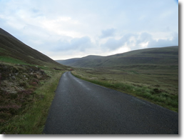
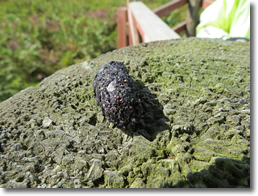
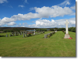
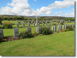
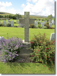
13.08.13 - Hoy to Kirkwall
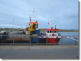
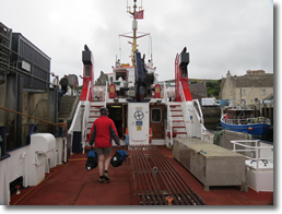
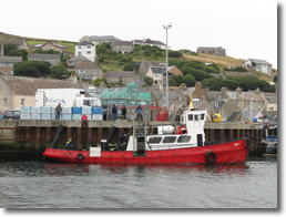
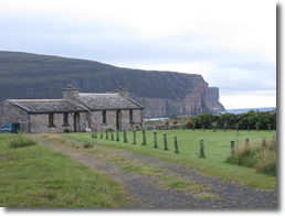
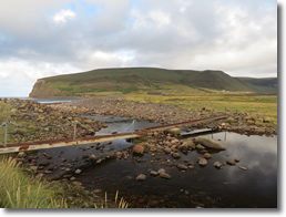
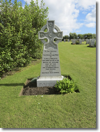
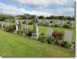
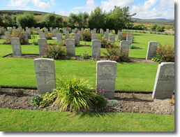
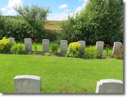
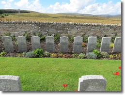
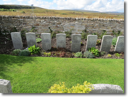
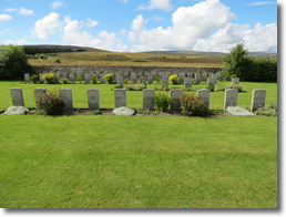
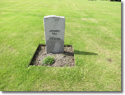
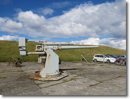
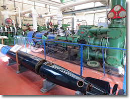
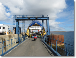
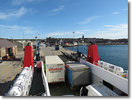
As we were packing the last bits on to the bikes the bothy warden turned up and we had a chat with him as we walked the bikes up the track from the bothy. I mentioned to him about the locked gates and the fact that we will have to lift the bikes over. He laughed and said we didn’t have to and proceeded to lift the kissing gates that were by the side of the gates off their hinges so we could easily push the bikes through. If only we had known that on the way down! It was a lovely morning as we cycled out of Rackwick and it didn’t take too long to climb up and over to the B9047. There was hardly any traffic on the road and it was very pleasant cycling through undulating moorland with some beautiful views over Scapa Flow. There were some lovely names of the places along the coastline ‘Nose of the Bring’, ‘Candle of the Sale’ and ‘Flossy Groups just to name a few. At Pedal Burn we stopped at the little picnic area where there just happened to be a cache and while we were there we found an owl pellet nice placed by the owl on top of a gate post. It was a short hop from there to Lyness where we stopped to have a look at Naval Cemetery. It was so sad to see so many naval ratings and officers final resting places from the various two world wars, at least they were fortunate to have been buried on land as so many went down with their ships at sea. Although we had brought a fair amount of food with us from Stromness we were running out of fresh things for lunch and were hoping to find a shop for a drink and something to eat. There didn’t seem to be much apart from a hotel which advertised hot food until 2.30pm. Well it was 2.40pm we wondered if at least we could get a drink and a packet of crisps. Fortunately it was open and I asked the guy behind the bar if there was any chance of something to eat. No problem would Fish & Chips be OK. Well it was the best Fish & Chips that we have had in a long while, the fish was so fresh and tasty and the batter was so light and it really hit the spot. Fortunately in the hotel there was a timetable for the Lyness to Houton ferry and we worked out that we had a couple of hours before the ferry went so it gave us some time to go and visit the Scapa Flow Visitors Centre and museum. It is based at the old naval oil and fuelling station at Lyness with the main exhibition in the old pumping station. We really could have done with more than 2 hours as was really interesting detailing the history of Scapa Flow as a naval base during the two world wars. The Ferry ride to Houton was very straight forward and again I just love the names for things around here as we passed by the rather quaintly named rock the ‘Barrel of Butter’ there is obviously a story around that one! It was a straight forward ride to Kirkwall along the A964 a little undulating in places but as it was getting late so we hacked on to get to the supermarket and then the campsite that wasn’t too far away.
| Click on the thumbnail images below to see a larger version in a pop up window | |
 |
 |
 |
 |
 |
 |
 |
 |
 |
 |
 |
 |
 |
 |
 |
 |
 |
 |
 |
 |
 |
 |
 |
 |
 |
 |
 |
 |
 |
 |
 |
 |
 |
 |
 |
 |
 |
 |
 |
 |
 |
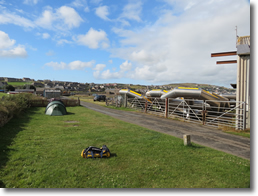
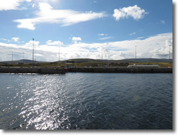
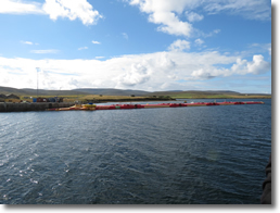
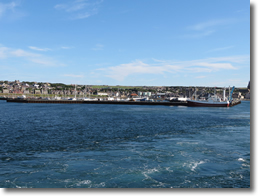
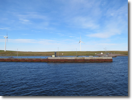
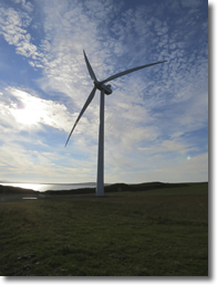
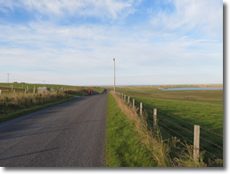
14.08.13 - Kirkwall to Sanday
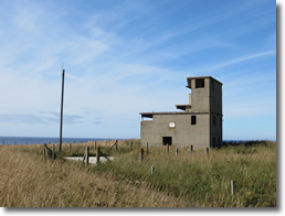
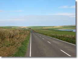
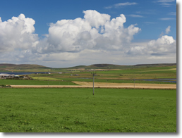
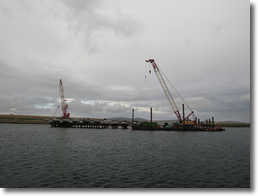
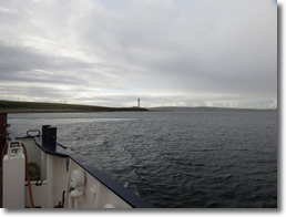
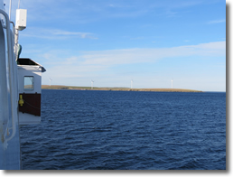
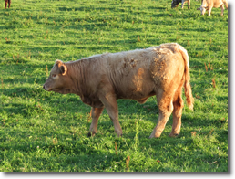
The ferry didn’t leave until 15.40, so we had a bit of time to explore around Kirkwall before heading off to the ferry. It was a lovely afternoon and we got some good views of the other islands as we headed across the Wide Firth. We passed close to Shapinsay and we could see the search light and gun batteries that had been put in place to protect the approach to Kirkwall during WWll. As we got to Gairsay sound we could see the experimental tide turbine that they have been using to generate electricity. Looking at the strong currents running in the sound you could see why. We passed between Egilsay and Eday before approaching Sanday in Rapness sound. Near the ferry terminal at Rapness they have built several large wind turbines which was probably a good spot as that end of the island is uninhabited. It was a lovely afternoon as we cycled along the the B9050. After the initial ferry traffic there was very little traffic on the road as we worked our way along the spine of the island with a couple of zigzags up a couple of small inclines. Being quite flat countryside, Sanday is all mainly farmland with grazing meadows for cattle and sheep and as we cycled along there were several curlews in the fields. It didn't take too long to get to our turn off to the campsite. The campsite itself is quite nice as it overlooked a small rocky bay. Apart from a couple in a motorhome and a family in one of the camping huts we were the only ones camping.
| Click on the thumbnail images below to see a larger version in a pop up window | |
 |
 |
 |
 |
 |
 |
 |
 |
 |
 |
 |
 |
 |
 |
 |
 |
 |
 |
 |
 |
 |
 |
 |
 |
 |
 |
 |
 |
15.08.13 - Sanday
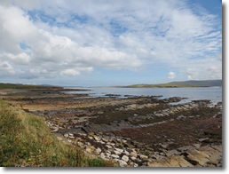
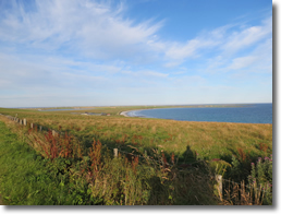
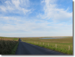
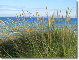
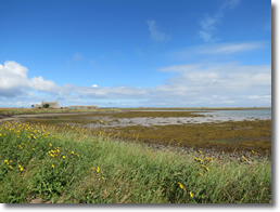
I woke up fairly early and popped my head out of the tent door to see what the weather was like. It was reasonably bright morning with a few clouds in the sky. The tide was in and I thought I would scan the bay for Otters as the campsite owner said he had often seen them in the bay. My luck was in as I spotted an Otter moving around in the water near the rocks on the far shore. I dashed back into the tent to wake up Frank who quickly got dressed and came out to have a look. We hoped that it might swim over to the shore nearest us, however we were out of luck as the Otter dived one last time and must have then swarm around the wee headland as we saw it no more.
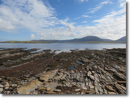
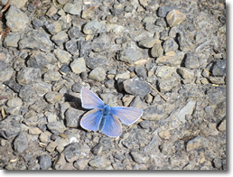
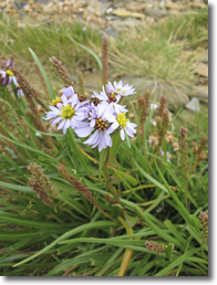
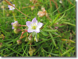
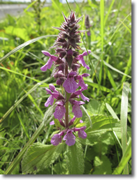
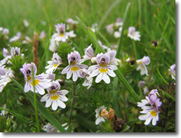
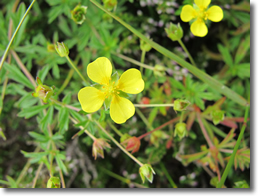
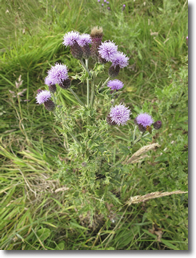
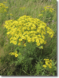
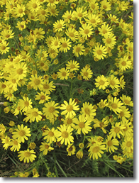
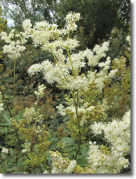
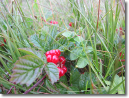
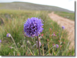
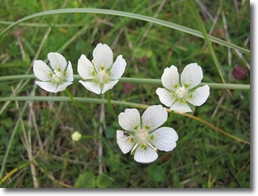
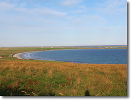
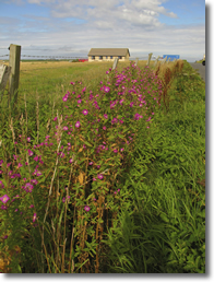
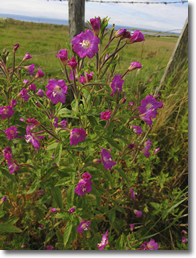
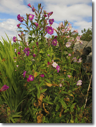
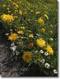
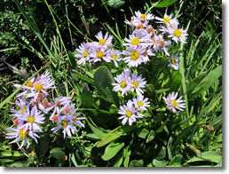
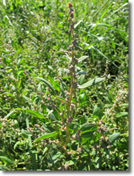
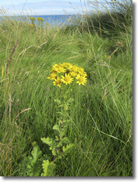
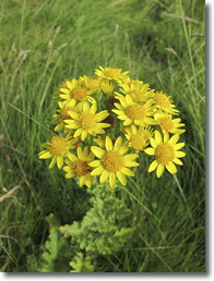
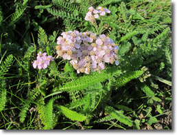
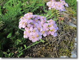
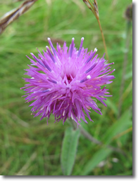
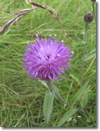
After breakfast we went off exploring around this wonderful island. We first went to the interestingly named Lady village to stock up at their community shop and then we cycled down to Els Ness to have a look at the Quoyness Chambered cairn which was really interesting. Frank was in her element as there were loads of wildflowers to see and take photos of. The tide was out on the Little Sea and it was full of waders, mainly Knot, Dunlin and Black tailed Godwits. From there we headed up north to Roos Wick to do a cache which was up a farm track near a wonderful whale skull.
| Click on the thumbnail images below to see a larger version in a pop up window | |
 |
 |
 |
 |
 |
 |
 |
 |
 |
|||
 |
 |
 |
 |
 |
|||
 |
 |
 |
|
16.08.13 - Sanday
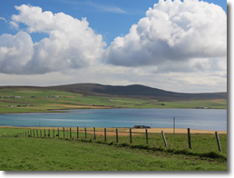
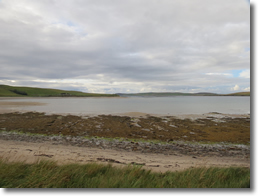
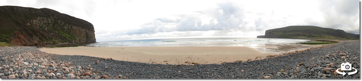
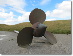
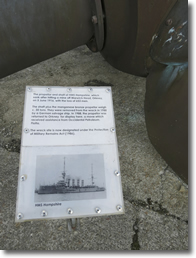
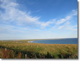
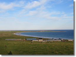
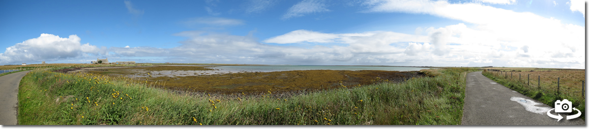
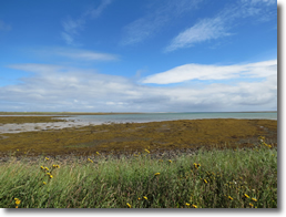
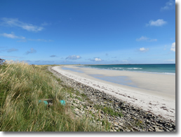
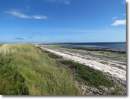
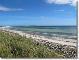
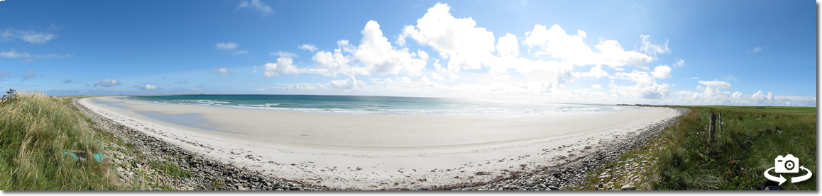
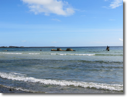
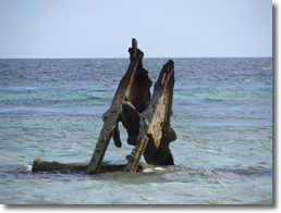
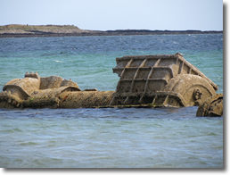
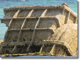
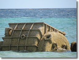
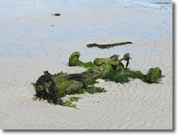
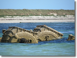
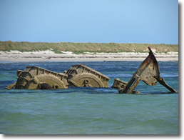
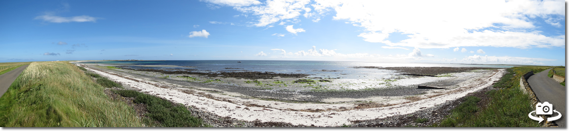
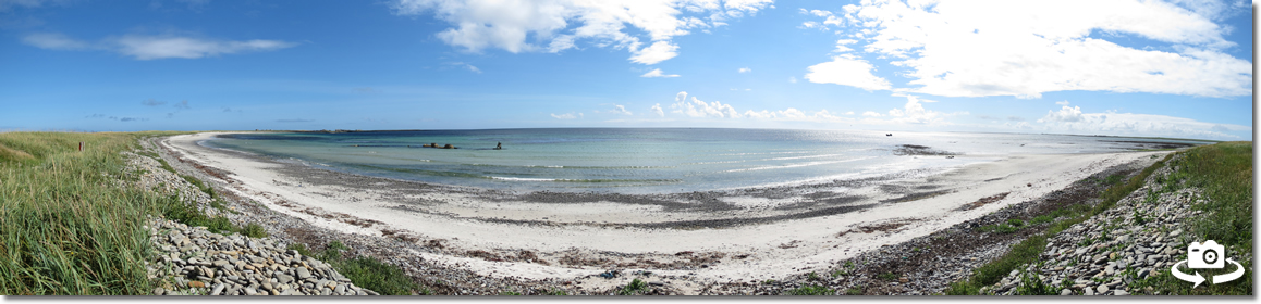
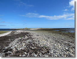
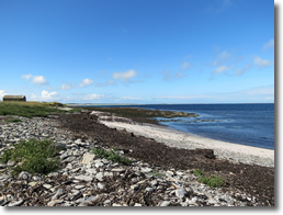
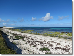
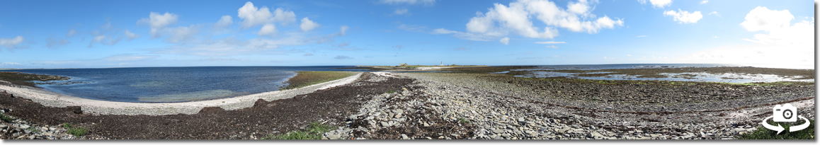
It was another glorious day and we decided to head out past Otterswick through Lady Village to the furthest point west of the island. The tide was out as we looked across the vast Cata sands to the sand dunes that make up Tres Ness. On reaching the Bay of Lopness the sweeping white sandy beach was amazing and quite beautiful. Stuck in the middle of the bay covered in the barnacles is what was left of the wreck of the German Destroyer B98 from World War I. The German Fleet was interned in Scapa Flow at the end of the First World War and on 21 June 1919, orders were given by the German High Command to scuttle the whole fleet. Some remnants of the fleet were shared amongst the allies, one of these being the B98, which had operated as a mailboat. As it was being towed away, the B98 broke her tow and went aground in the Bay of Lopness. Much of the wreck was cut up for scrap in the 1940's and one of its guns we saw on display at the Maritime Museum in Lyness, Orkney.
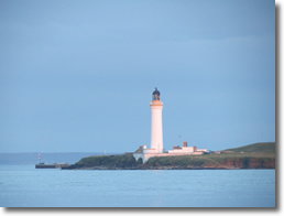
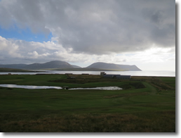
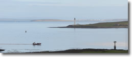
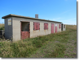
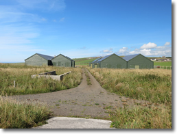
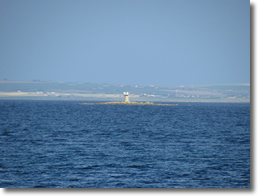
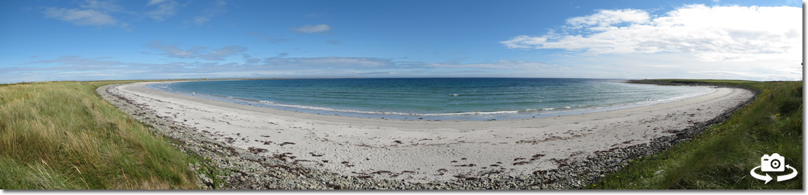
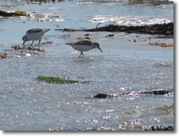
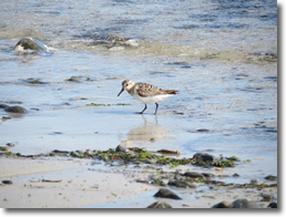
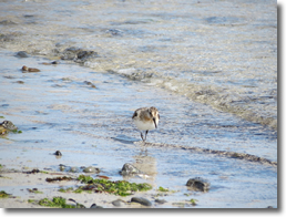
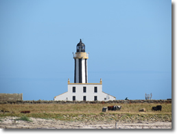
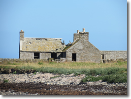
Running around on the foreshore were several Sanderlings looking for a wee snack and the waves kept rolling in. Further along the B9069 we came to its end and turned off to have a look at the bay of Scuthvie and Ayre Sound which at low tide you can walk across to Start point which has a distinctive Lighthouse. Unfortunately the tide was n’t in our favour so we headed back to the end of the B9069 and went up through Lettan past the abandoned buildings from the former WWll radar station of RAF Whalehead to skirt around the North Loch to tofts before heading back to the B9069. On our way back we past again the Sanday golf course and I hadn’t noticed that they had fences around the greens to keep the sheep off! To make a change we went back to the campsite via Otterwick. A really pleasant day, Sanday is such a nice place to cycle.
| Click on the thumbnail images below to see a larger version in a pop up window | |
 |
|||
 |
 |
 |
 |
 |
 |
 |
 |
 |
 |
 |
 |
 |
 |
 |
 |
 |
|||
 |
 |
 |
 |
 |
 |
 |
 |
 |
 |
 |
 |
 |
|||
 |
|||
 |
 |
 |
 |
 |
 |
 |
 |
 |
|||
 |
 |
 |
 |
 |
 |
 |
|