


 The Celtic Cycling Circle
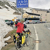 Cycling alongside the Grand Union Canal
 5 Essential Items to Take with You on Your First Cycling Tour
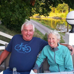 Favorite Cycling Destinations: Sardinia
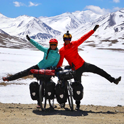 Pamir to Karakoram- cycling the highways on the roof of the world
 4 Wheels 2 Hearts 1 World - A Day in Our lives
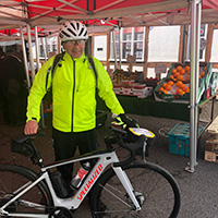
 Koga E-Worldtraveller - e-bike review
 Ten tips for tandem cycle touring
 colmandsamstreks - Two Beginners in France
Iceland 2009 - The 'Baptism of Fire for a Lightwave' Tour
Part 2 - Pingvellir, Kaldidalur route, Surtshellir and the Anarvatnsheiði.
 01.08.09 - Reykjavík to þingvellir
After breakfast we checked out Frank’s front wheel, it turned out to be a false alarm as the crack was in fact a fine but deep scratch that went right across the rim wall, it was quite a relief as finding a good 700cc wheel might have been difficult even in Reykjavík. With the bike back together we started out late from Reyjavik campsite and followed route 1 out of the city. The road was very busy and we attempted to find some alternative cycle ways but signposting was not altogether clear and we strayed away from route 1 on a couple of occasions and found ourselves backtracking and returning to the main road. In the end we decided to stick with route 1 although with the heavy traffic while frequently wondering why so many cyclists chose this route as the main goal of their holiday. We concluded that we would be the only cyclists whose goal was to spend as little time on route 1 as possible.
As we reached the outskirts of Reykjavík the traffic improved and so did the view out towards Mosfellsdalur. We turned off route 1 at Reykjahalid and stopped for some lunch near the site of an old base used by the Tommies during the world war II. There was actually a cycle route from Reykjahlid through to Laxnes where there was a museum to one of Iceland’s most famous writers. Just behind the museum we stopped to do a little geocaching close by. We followed route 36 through to þingvellir enjoying lovely views across þingvallavatn before a great descent to reach þingvellir campsite. It was an Icelandic Bank holiday weekend so it was fairly busy and we were told by the campsite wardens that if there was any problem with noise for us to contact them and they gave us a mobile number to call. Obviously they had had a few problems before on bank holidays. There were several fields and we choose one which had the least people in it and found a side away from most of the trailer tents. That evening there was some signing from a group in the corner but otherwise it was fairly quiet.
| Click on the thumbnail images below to see a larger version in a pop up window |  |
 |
 |
 |
 |
 |
 |
 |
 |
 |
 |
 |
 |
 |
 |
02.08.09 - þingvellir
As þingvellir is such an historic place for the Icelander’s and such a natural beauty in it’s own right we decided to spend a day exploring the area It didn’t take very long to cycle down to the car park where we left the bikes. We first explored the large Flosagjá rift where we found a lovely placed geocache which we decided was a wonderful place to start the journey of Christopher’s ‘British Bobby’s geocoin. From there we went round to see the þingvallakirkja, one of Iceland's first churches and þjóðargrafreitur the old Parliament which held the earliest Viking assemblies and then on to see the Lögberg the Law Rock. We went for a walk exploring the amazing water filled fissures and rifts and spent some time at the visitor’s centre finding out more about the old parliament and the geology of the area, as well as stopping for another geocache en route. On the way back down the Almannagjá rift to the bikes we walked up to see a waterfall cascading over the fissure into the Öxará leading to the drowning pool or Drekkingarfarhylur. We were extremely lucky with the weather as there was hardly a cloud in the sky with lovely sunshine.
| Click on the thumbnail images below to see a larger version in a pop up window | |
 |
 |
 |
 |
 |
 |
 |
 |
 |
 |
 |
 |
 |
|||
 |
 |
 |
 |
 |
 |
 |
 |
 |
|||
 |
 |
 |
 |
 |
 |
 |
 |
 |
 |
||
03.08.09 - þingvellir to Húsafell
We left þingvellir following route 52 and climbing steadily we had good views back across Pingvallavatan through the lava fields. After more gradually rising we hit a steep hill which skirted around the base of Armannsfell to reach Sandkluftavatn, a glacial lake. The dominant view at the top is of Skjaldbreidur - a shield volcano. We continued climbing up with good views of the volcano until we stopped for lunch by a small stream opposite the mountain of Kingindisfell 785m where we also decided to remove our cleats from our boots in light of the loose gravel road surface. When we reached the junction of the F550 there was a small lake and we could see some whooper swans swimming near the far shore. The weather changed as we reached the mountain hut near Biskupbrekka and it started to rain slightly. On the way down the next stretch we came across 2 casualties of the road. The first was a trailer, which had lost a rear wheel, the indespension unit had sheared off and the second was a jeep, which had lost a front wheel and had a sheared suspension arm. We were passed by a lot of buses on this section of the route noticeable as they seemed to appear every time we were about to climb up a steep hill. They weren't regular buses but converted ones being used as camper vans.
The next stretch became quite arduous and we were greatly elated to finally reach the cairn at the top at Langihryggur after a long drawn out stretch of expletive ridden false summits. We were joined at the top shortly after by a car traveling in the opposite direction whose occupants emerged stretching and groaning from the exertion of getting out of the vehicle. They shuddered from the cold in their thick fleeces and darted back into the car as we watched on amused as we were still in our shorts. The driver did venture over for a quick chat and was amazed to hear we had come from Þingvellir and that we were headed for Húsafell. He kindly took a photo of us at the cairn. It’s amazing how our spirits lifted after the summit as we realised that the rest was going to be downhill although we quickly succumbed to the cold and stopped to put on our leggings and fleeces. We were amused to pass signs for OK glacier but perturbed that there was something amiss with the others around and about.
The last couple of miles of the track as we reached the Gerta river were awful as the track became really loose rocks and gravel and on one particularly loose, steep downhill stretch we were both really relieved we were headed down it rather than trying to climb up it. There was an amazing sight at the bottom of this stretch of creamy mauve larva which ran alongside and into the river. We finally reached tarmac much to our relief and in the excitement of going downhill at speed, Jon missed the campsite turning and we had to do an about turn up the hill again (the expletives returned briefly). We were also a little disappointed to discover there were no showers at the campsite after such a long day although we could have had a swim at the pool if we had arrived earlier.
| Click on the thumbnail images below to see a larger version in a pop up window | |
 |
 |
 |
 |
 |
 |
 |
 |
 |
 |
 |
 |
 |
 |
 |
 |
 |
 |
 |
 |
 |
|||
 |
 |
 |
 |
 |
|||
 |
 |
 |
 |
 |
 |
 |
 |
 |
 |
 |
 |
04.08.09 - Húsafell
We woke to find that it was raining heavily and decided to take advantage of the campsite washing facilities as these were the first we had come across and also felt obliged to try out the geothermal swimming pool and hot tubs - a trial but someone had to do it, especially as we needed a shower. Later on in the afternoon we got chatting to the two English guys who were camped opposite us. They were from Yorkshire and had brought their trials bikes over in a van and were enjoying the gravel roads. I asked then which way they had come as I knew that the Scabster ferry had been axed. They had indeed caught a ferry but from Harwich to Esbjerg and then the ferry from Hanstholm in Denmark to Sey∂isfjör∂ur, quite a journey and must have cost them a bomb in ferry fees.
| Click on the thumbnail images below to see a larger version in a pop up window |
 |
 |
 |
|
05.08.09 - Húsafell to Norðlingafljót
We said goodbye to the two English guys and wished them good rides and set off heading north east along the F578 to Surtshellir where we spent a couple of hours exploring the extensive and very impressive lava tube system. Our tiny little button torches were not really strong enough to do the system complete justice but were helpful in avoiding too many ankle twists on the giant bolder hopping stretches underground. We would recommend anyone to visit these tubes as they are quite amazing, but be sure to bring a bigger torch. We must have spent a couple of hours there and after a quick brew we headed north up the F578 as the road wound its way through the Hallmundarhran lava field. Part way up we narrowly avoided being run over by a lunatic in a 4 wheel drive with massive balloon tyres traveling at breakneck speed who had no intention of stopping for anyone. He just drove straight at us until we braked hard and jumped out of his path. We had excellent views of the Eiríksjökull glacier to the east and over a series of small lakes to the west as we skirted the lava field along the sometimes rather rough and sometimes sandy track. As the weather semed to be closing in we decided to camp for the night next to the Norðlingafljót just before the ford at the tributary of the Stóralón Lake . After we had cooked our evening meal it began to shower with rain and we were then treated to an incredible evening of dark threatening rain clouds, rainbows over the glaciers and finally a stunning sunset over the lakes. It was such a 'wow' moment and it was difficult to know which way to look first. We actually got quite cold and rather damp having spent so much time out of the tent but it was well worth it as it was such an amazing evening.
| Click on the thumbnail images below to see a larger version in a pop up window | |
 |
 |
 |
 |
 |
 |
 |
 |
 |
 |
 |
 |
 |
 |
 |
 |
 |
 |
 |
 |
 |
 |
 |
 |
 |
 |
 |
 |
 |
 |
 |
 |
 |
 |
 |
 |
 |
 |
 |
 |
 |
 |
 |
06.08.08 - Norðlingafljót to Álftakrókur
We started the day with an early morning dip as we crossed the ford. It was very very cold but thankfully not too deep. After the ford however, today proved to be a very difficult day to ride with incredibly high winds as we were blown off our bikes on several occasions. We literally managed to travel 5 miles with a combination of pushing and riding our bikes struggling to keep them and us upright before we reached a mountain hut at Álftakrókur where we decided to stop as it was getting increasingly difficult to stay upright. Fortunately we proved to be the only guests that night and we had a relatively comfortable night although the wind did get so strong during the night that the mountain hut started to shake.
|
|||
 |
 |
 |
 |
 |
 |
 |
 |
 |
 |
 |
 |
 |
 |
||
07.08.09 - Álftakrókur to Laugarbakki
The day started with heavy sleet and some snow so we waited until things had calmed down a little as the wind was still very strong before we started out. It was a very cold start as we followed a rather convoluted track which eventually seemed to go full circle while gradually gaining height. We had some good views of the Langjökull and the Baldjökull glaciers. We had originally planned to take the track across the Storisandur to meet up with the Kjölur route but we were beginning to get low on food and the wind was so strongly against us still that we decided to head North West instead towards the North Coast. As we reached the shores of Arnavatn we heard the wonderful sound of a Great Northern Diver and spotted it about 100m out in the lake. It is such a haunting sound, you can understand when you hear it why the American’s call them ‘Loons’. As we skirted around the lake we startled a female Ptarmigan with several chicks by the side of the road and managed to take some photos of her and her chicks. When we reached the far side of the lake there was a small settlement of huts and a mountain hut where we stopped for lunch as it was pouring with rain by then. It was a fortunate find as we were starving by then and it would have been quite cold brewing up by the side of the road. By the time we had finished our lunch the rain shower had past us by. After a brief climb up from the lake the riding became a lot easier as we began to have the wind on our backs, part way along we saw a 4x4 stop ahead of us and the driver got out. He waved to us to stop he wanted to know where we were from and was amazed that we had come so far over the Arnavatnaheiða. He offered us some brandy but we politely refused and thanked him for being so generous. He said he was going fishing at Arnavatn for the weekend. It was going to a memorable or perhaps a 'can't remember' trip if he had started drinking this early on! We wished him good fishing and he wished us a good holiday. As we began our descent along the Austurádular, the scenery began to change as we gradually got lower with more greenery and the odd pocket of trees. We followed the river down until we reached a stretch of the track that can only be described as like cycling along a river bed with large boulders, sand and gravel. It proved to be impossible to ride for a while and we had quite a job pushing the bikes across this particular stretch. Once we climbed up away from the river bed the track improved again as we made our final descent into Laugarbakki. The campsite was behind what was obviously an old petrol station and the building was being used as a craft shop. The campsite fee included the use of a Hot tub which certainly helped to ease the legs, we were joined by an Austrian couple who we got chatting to and they turned out to be teachers who had just retired that July!
|
|||
 |
 |
 |
 |
 |
 |
 |
 |
 |
 |
 |
 |
 |
 |
 |
 |
 |
 |
 |
 |
 |
 |
 |
 |
 |
 |
 |
 |
 |
 |
 |
|
08.08.09 - Laugarbakki to Hvammstangi
Our plan was to head up to Siglufjörður as we wished to visit a cache there to place our ‘5th Compass Anniversary Geocoin’ which we wished to start on its way south. However we thought it would take too long to cycle there and it would mean cycling along way along route 1, which we had vowed to avoid. According to our timetable there wasn’t a bus to Siglufjörður the next day, but we worked out that if we rode to Hvammstangi and spent a night there there was a bus the day after. It meant we could have a bit of a lazy morning as it was only 10km to Hvammstangi. In fact it didn’t take that long as after the initial hill it was downhill to Hvammstangi. We visited the supermarket before heading to the campsite which as always was up hill and past the horse racing track or that is what we thought it was. Later after we pitched the tent we went to find a cache in the small wood behind the campsite. Small rather described the size of the trees as well as the size of the forest. We were rather unsuccessful in our hunt and returned to the tent. As there was still time I rode over to investigate the race course. I got chatting to a pair of Austrian sisters who were in Iceland for 2 months working on a farm looking after the horses. It was in fact a horse show rather than racing, each horse had to do a series of different trots and they were marked on style.
|
|||
 |
 |
 |
 |
 |
|||