


 The Celtic Cycling Circle
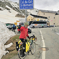 Cycling alongside the Grand Union Canal
 5 Essential Items to Take with You on Your First Cycling Tour
 Favorite Cycling Destinations: Sardinia
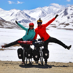 Pamir to Karakoram- cycling the highways on the roof of the world
 4 Wheels 2 Hearts 1 World - A Day in Our lives
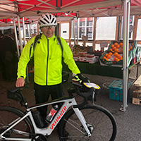
 Koga E-Worldtraveller - e-bike review
 Ten tips for tandem cycle touring
 colmandsamstreks - Two Beginners in France
 Denmark Mini Tour 2017 - Aalborg - Blokhus - Løkken - Hirtshalls - Skagen
The second of our Danish mini tours.
13.08.17 - Aalborg to Skovgården Shelterplads
 We had arranged with the campsite owner that we could leave our car in a field adjacent the campsite. So having packed everything up on the bikes I left the car where the lady had indicated and we set off. Our plan was to head west from Aalborg on cycle route 55 to get to the coast and then follow route 1 up the coast as far as Skagen. After all the heavy rain that we had had yesterday it was a bright sunny day as we followed the the cycle route which took us past the harbour and then over a pedestrian and cycle bridge over the river to the northern side of Aalborg. It was pleasant cycling on cycle paths through a park and then through some residential areas with modern flats although there was a bit of a head wind coming off the water. Fortunately the cycle route took us inland to Voerbjerb past some allotments and summer houses to a small lake which was obviously used for water skiing. The route was lovely as apart from a very short section alongside the main road we had been on tracks and we hadn't seen any cars.
Just before Torpet we continued on what must have been an old railway line which continued all the the way to Aabybro and a little way beyond. The first bit was on fine gravel but at Biersted it became tarmac. It was so pleasant to ride along with fields of wheat and barley interspersed with a few woods. At Vadum there was a little diversion off the railway line via some small country lanes but after a couple of kilometres we were back on the old track bed. One kind cacher had placed lots of caches along the way which made for a bit of fun finding them. At Biersted we stopped for some lunch at the Shelterplads that was just off the cycle path before continuing on along the old railway path till we got to Aabybro. Here we stopped to buy some supplies but as we left the town we picked up the cycle route which again followed the old railway line which finally stopped at Ryå where we met a road which fortunately had a convienient bus shelter so we took advantage of its seat to stop and have a brew.
From Ryå we were now on proper roads but there wasn't much traffic. We cycled on for a few more miles amidst woods and farmland until we got to Moseby where we started to look for the Shelterplads. We got to where it was marked on the Shelter app and there was a small wooden sign with faded writing on it and we could so easily have missed it. We followed a track down through the woods which brought us out in a field and the Shelterplads was just down the field edge. There were two shelters and a camp fireplace. The shelters were in good repair and after I had popped along to one of the houses that were back on the road to get some water we settled in for the night. The shelters were nicely situated as they caught the evening sunshine and later after we had eaten our evening meal we were treated to a lovely sunset.
| Click on the thumbnail images below to see a larger version in a pop up window |  |
 |
 |
 |
 |
 |
 |
 |
 |
 |
 |
 |
 |
 |
 |
 |
 |
 |
 |
 |
 |
 |
 |
 |
 |
 |
 |
 |
 |
 |
 |
 |
 |
 |
 |
 |
14.08.17 - Skovgården Shelterplads to Løkken
We had a very peaceful night and we had been quite comfortable in the shelter. After some breakfast we packed the bikes and headed off towards the coast. We were initially on quiet roads and at Mosetoget we stopped at a small grassed area where there was an old locomotive and a few wagons on a small length of track apparently it was a train that was used to move clay to a brickmakers nearby. There was a multi cache associated with the spot so we decided to solve the questions and find it. The final stage took us through the lovely woods that were close by. A little further on we picked up route 1 and the route then took us through into a small forest on good tracks which eventually brought us into Blukhaus.
Blukhaus is very much a seaside town which although it has a very modern with a central square surrounded by modern shops it had some lovely old thatched buildings most of which seem to be restaurants or bars. We stopped at the Tourist information office where I bought an up to date map. Although we have moved to using electronic maps on my phone and the cycle routes in Denmark are well marked I still quite like following a paper map in the map case on my barbag I have decided . As we were in a town we decided that as it was lunchtime we would find a restaurant and have some lunch. Suitably refreshed we headed off along route 1 which took us through the town and on to the strand. It was very much like the strand on Fanø with hard packed sand which was easy to ride on but unlike Fanø strand this went on for 15km to Løkken. Like Fanø strand cars and buses drive up and down it and there were cars and camper vans parked in various points along the beach with people bathing and children building sandcastles or flying kites. As I was cycling along an ice-cream van came alongside and I had a chat with the guy driving it. He was asking us how far we had come and how far we were going. I asked him how the ice cream sales were going and he wanted the weather to warm up a bit more as proportionally he sold more ice-cream as the temperature went up. We stopped part the way along the strand to try and take a photo of the both of us to put on our Facebook page. We wanted to get both us and the bikes in the shot so a handheld selfie with my phone wasn't going to work so I was trying to balance my phone on the top of a litter bin when a couple on bikes stopped and the young lady asked me if it would be easier if she could take the photo for us. They were a young couple from Copenhagen who were staying in one of the chalets that were dotted about in amongst the dunes. We thanked them and wished them well for the rest of of their holiday.
It was just while I was putting my phone away that I noticed a man running across the dunes towards us. He was stark naked and ran passed us dodging the cars that were passing and ran into the sea and began swimming. Obviously a common occurrence on Danish beaches as no one batted an eyelid! As we got towards Løkken the sand started to get a bit soft so we had to move on to the wave washed hard pack next to the sea. It was lovely cycling along with the waves crashing gently to our left. We soon got to Løkken and turned up the hard and into the town itself. Løkken is another big seaside resort, after visiting a supermarket we soon found the campsite. It was a nice campsite more geared up for caravans and it had a lot of cabins for hire. I asked for a quiet location and the guy at the reception directed me to a nice grassy area between a row of cabins and not too far from there kitchen and lounge area. This must have been one of the best we have come across it was really light and clean with superb cooking facilities. It gave us an opportunity to relax and charge up the phones and chat with some Danish couples who were watching a local football match on the TV in the lounge area..
| Click on the thumbnail images below to see a larger version in a pop up window | |
 |
 |
 |
 |
 |
 |
 |
 |
 |
 |
 |
 |
 |
 |
 |
 |
 |
|||
 |
 |
 |
 |
 |
 |
 |
|
15.08.17 - Løkken to Lønstru
It was quite overcast as we set off this morning and as we left Løkken there was a very unusual sky, the clouds all looked pockmarked. I have never seen such a cloud formation like it before. Our route this morning was generally on small roads as we cycle out of Løkken and at Nørre Lyngby we past a sign to the ‘Fishermans Rest’ an English Pub selling ‘Fish & Chips’. If it hadn’t been so early in the day we might have been tempted! When we got to Sønder Rubjerg route one took us along a main road which in comparison to others was fairly busy with tourist traffic going to visit the Rubjerg Knude Fyr. We stopped at a museum just north of Nørre Rubjerg at the old coastal farm of Strandfogedgården it was very interesting as although it was in Danish it had some good exhibits explaining the geography and geology of the North Jutland coastline.
After stopping for some lunch at the museum we headed back up the road and a little further on from the museum we could see the huge sand dunes that make up Lønstrup Klint that dominates that part of the coast. Situated in amongst them is the Rubjerg Knude Fyr. It is a lighthouse that sits on the top of Lønstrup Klint which is a 60m cliff above sea level. The lighthouse was originally built in 1900 but eventually stopped functioning as a lighthouse in 1968. The sands shifted so quickly that the original buildings that were surrounding it that were once used as a museum and coffee shop were swallowed up by the shifting sands and were abandoned in 2002 and later demolished in 2008. The lighthouse tower remains but not for much longer as the erosion on that coast line is 1.5m a year and by 2023 the lighthouse will probably have fallen into the sea. It was a good walk across from the carpark to the lighthouse and back and there were a couple of caches to find along the way. We had a good view from the top of the lighthouse looking back in land at the lovely white painted Kirke at Gammel Venebjerg.
From the Rubjerg Knude Fyr it was only a short ride into Lønstrup and it was good timing as it was 5.30pm, time to find the supermarket and then the campsite. Our timing was also just right again as no sooner had we got the tent up at the campsite then it started to rain. Fortunately the campsite had a kitchen and a place to eat our evening meal. That evening as we got into our tent we found we had a visitor, a great big toad who had obviously come out with the rain to have an explore around for food.
| Click on the thumbnail images below to see a larger version in a pop up window | |
 |
 |
 |
 |
 |
 |
 |
 |
 |
 |
 |
 |
 |
 |
 |
 |
 |
 |
 |
 |
 |
 |
 |
 |
 |
|||
 |
 |
 |
 |
 |
 |
 |
 |
 |
 |
 |
 |
 |
 |
||
16.08.17 - Lønstrup to Hirtshals
After last night's rain we woke to a bright sunny morning and after packing up the tent we sat outside the kitchen area to eat our breakfast and to soak up the morning sunshine. After our breakfast we headed back up route 1 which was mostly on small roads through a myriad of summerhouses through Harrerenden and then the seaside resort of Skallerup. Just after Skallerup we must have made a slight wrong turn somewhere as we ended up in the Klithusegaarden equestrian centre which didn’t seem to matter as it was open to the public. We stopped for a while to look at the horse and ponies and watch a farrier shoeing a horse which we always find fascinating.The route from there took us to the Skallerup Inlanddunes reserve. Just as we got to the little visitors center we meet a family of tourers who were cooking a meal on a Trangia stove on the picnic bench outside. They were a family from Sweden cooking up their lunch, I said that it smelt good but the young lad didn’t look too impressed. They had been out touring for a few days and staying in the shelterpads en route. They reckoned that they now needed a campsite for a good shower. We told them that the site at Lønstrup was good and had good showers.
The visitors centre was interesting as it was obviously an converted old barn. What was interesting was the fact that the cycle route was signposted right through it. Unfortunately the interpretive boards were all in Danish but we got the gist of what was on the reserve. Several Swallows had made their nests in the roof of the centre and kept flitting in and out of the two entrances and there were several young Swallows sitting on the roof beams waiting to be feed. Once we had left the reserve we were back going through to open farmland with some ripe Oat fields ready to be harvested near Kæsgård. From there the cycle route took us through the Tornby Plantage. We decided to stop for some lunch at a couple of picnic benches at a car park just into the woods. There were a couple of other tourers sat at one of them and we said hello and got chatting to them. They were Isabelle and Peter from Colorado who were doing the North Sea Cycle Route from Bergen to Hamburg. We talked about how we had toured parts of the NSCR ourselves and they were interested in doing the British section which we haven't as yet done. We talked about that idiot Trump, they like us couldn't believe that he got elected. They said that in the poor Afro-American areas they had to queue for up to 4 hours to vote as they had deliberately put in too few polling stations. We talked about the Shelterplads and I showed them the Shelter app. After a long chat we finally said our goodbyes and wished them well for the rest of their tour.
The track through the plantage was undulating and at one point we came to a bend in the track and there was a proper road sign with ‘Løse Sten’ written on it. Sure enough there was a steep drop to a bend with loose stones which we took carefully. What cycle route in a forest in the UK would have a proper road sign or even a warning sign of some sort? The plantage was obviously popular with horse riders as we came across several. When we got to the outskirts of Hirtshals we spotted the lighthouse and the sign to the bunker museum and we turned in to have a look at it. They opened up one of the Bunkers and there was an exhibition in it and a couple of the rooms laid out as they would have been during WWII. Outside there were an extensive network of bunkers and radar stations. We explored a few of them and then had a look at the lighthouse climbing right to the top.
| Click on the thumbnail images below to see a larger version in a pop up window | |
 |
 |
 |
 |
 |
|||
 |
 |
 |
 |
 |
 |
 |
 |
 |
 |
 |
 |
 |
 |
 |
 |
 |
 |
 |
 |
 |
 |
 |
 |
 |
 |
 |
 |
 |
 |
 |
 |
 |
 |
 |
 |
 |
 |
 |
 |
 |
 |
 |
 |
 |
 |
 |
 |
 |
 |
 |
|
17.08.17 - Hirtshals to Tversted Plantage
We wanted to go on the Bunker tour which was at 2.00pm so we decide to go to the Nordsøen Oceanarium in the morning. The Nordsøen Oceanarium is the biggest sea life centre in Northern Europe and it was quite interesting place with numerous different tanks full of different types of fish which you could get right close to see the fish. It was a enormous building with several levels and you really need the plan they gave you to navigate around it. We heard announcements for the Seal feeding and it took awhile to work out how to get there as it was outside but up a level. When we eventually found it was one of the best bits as the seals were so comical when feeding and it was quite fun to watch. After having some lunch at the restaurant in the Oceanarium we headed back over to the lighthouse and the Bunker museum only to find that I had misread the sign and that they only did the tours in July. We decided anyway to go explore the area ourselves. One of the bunkers had been taken over by the local primary school and the children had turned it into a garden. It was quite nice to see a icon of war turned into something peaceful.
After exploring the various bunkers which were very similar to the ones we had explored on Fanø we thought we had better get going if we were to get to Skagen. On getting back to the bikes we bumped into 9 Norwegian guys who were touring on various odd bikes, there was 3 guys on a extended tandem pulling a huge Plastic Tuborg beer bottle on a trailer, two guys on cargo bikes one with a trailer with a sound system on it. And a couple of others on standard bikes with trailers. We got chatting to them they had just got off the ferry and were going to tour around Denmark. They had been doing this tour together for the last 12 years, we called it the ‘Jolly Boys Outing’ after the Only Fools and Horses TV show. We said our goodbyes and wished them well for their tour. It didn't take us too long to get back across Hirtshals and back on to route 1. We were soon back on easy-going gravel tracks through the woods of the Lillelien Klitplantage. Frank always likes cycling through woods as there are usually plenty of fungi to photograph and at one point she found this huge Wood Ant nest which must have been at least 3ft high. Unfortunately the good weather of the morning hadn’t lasted and it become overcast but it wasn't cold. The route took us along more forest tracks through the Uggerby Plantage where we came across this amazing mobile wood chipper. The guy operating it was so adept with his use of the grab arm and he made short work of clearing a huge pile of fir tree tops and brashings.
As we approached Tversted the track passed through sand dunes and there was a lovely arched bridge over the Uggerby Å. When we got to Tversted village we ask a guy for directions to a supermarket and he directed us to one that was only a couple of hundred meters down the road. Suitably provisioned up we head back onto route 1 on a small road until we got the Tversted Plantage where we were again back on to forest tracks. We soon found the Shelterplads which was just off the track near the Østerklit Stokmølle which was a lovely old mill. One of the shelters was being used by a family so went and used the other one. I went over to the mill to get some water and we sat in the shelter having a brew. The family in the other shelter packed up their bikes and headed off, we thought it was a little late to be setting off. But about 5 minutes after they left it absolutely threw it down with rain, 10 minutes later the family reappeared and got back in the shelter. It rained solidly for the rest of the evening so it was probably a good idea that the family did turn back as they would have got absolutely soaked. .
| Click on the thumbnail images below to see a larger version in a pop up window | |
 |
 |
 |
 |
 |
 |
 |
 |
 |
 |
 |
 |
 |
 |
 |
 |
 |
 |
 |
 |
 |
 |
 |
 |
 |
 |
 |
 |
 |
 |
 |
 |
 |
 |
 |
 |
 |
 |
 |
 |
 |
 |
 |
 |
 |
18.08.17 - Tversted Plantage to Skagen
After it had been raining all night we woke to a beautiful morning. What a lovely spot to wake up in. It was quite still and there was a mist over the heath and heather and the windmill looked pristine white in the morning sun. Everything was steaming in the morning sunshine after the night's rain and there were small frogs jumping across the path as I walked across to the mill to go to the loo. There were Swallows and House Martins zooming around the building and perching on the sails of the windmill. Inside the windmill the old machinery was all still there and there were some old wagons and a sledge. As I returned I met Frank coming across the heath she too commented on the number of frogs. On my return I got the stove going and we had breakfast. One of the nice things about using the shelterplads is that you don’t have a tent to pack up and after last night's rain it would have taken a while to dry it out, although in the morning sunshine it perhaps wouldn’t have take too long. Just before we left we went over to have a chat with the family who were in the other shelter. They were from Hungary and were cycletouring around Denmark and were off to Hirtshals the way we had come yesterday. They were hoping to go to the sealife center and we told them that they would enjoy it and we wished them well for the rest of their journey.
Our route to Skagen took us again on forest tracks out of the Tversted Plantage to Skiveren where there were some lovely thatched houses with pink rendered walls they reminded us of being back in Suffolk. From Skiveren we joined a road which took us to the white painted Råbjerb Kirke. We had been heading east but a couple of kilometres from the Kirke we turned north on more tracks across heath and dunes and passed close to the Råbjerg Mile which was a huge set of sand dunes and we could see people standing on top of them. The whole of this top end of Jutland is built of shifting sand moved by the action of wind and waves and the tip at Grenen above Skagen is growing daily. From the Råbjerg Mile we back into the forest of the Bunken Plantage and guess what it was full of concrete bunkers but this time judging by the design these were not German bunkers from the Atlantic wall but looked more modern probably from the cold war. After the Plantage we came to the village of Hulsig where the cycle route took us past the local railway station just as train was about to come in so we stopped to have a look. They were spanking new trains with sliding doors and the carriage was level with the platform and we watched a lady easily push her bike onto the train. They were so much nicer than our old Greater Anglia trains.
From Hulsig our route took us north on a good tarmac cycle path initially across heathland and then in to the into the Skagen Klitplantage. It was a popular cycle path and we met quite a lot of recreational cyclists. In the forest there several picnic benches along the path complete with there on water standpipe, these Danes have things well organised. We soon reached Kirkkilit where our campsite was. It was a lovely afternoon when we got to the campsite and we put up the tent and got the gear inside. We decided that we would have a cup of tea before we headed off to have a look around Skagen. To save time we decided to use the cooking place at the campsite it gave us an opportunity to charge our phones. Mine phone being completely flat as I was without the e-werk. I must admit both of us nearly fell asleep sitting there and Frank said if we don't get going soon we will never get going. Just as we left the cookhouse it started to spit with rain so we hurried back to the tent. We hoped that it was a shower but it rained almost continuously throughout the rest of the afternoon, that evening and the night. It was so heavy at one point during the night that it woke us both up as it hammered down on the tent.
| Click on the thumbnail images below to see a larger version in a pop up window | |
 |
 |
 |
 |
 |
|||
 |
 |
 |
 |
 |
 |
 |
 |
 |
|||
 |
 |
 |
 |
 |
 |
 |
 |
 |
 |
 |
 |
 |
 |
 |
 |
 |
 |
 |
 |
 |
 |
 |
 |
 |
 |
 |
 |
 |
 |
 |
 |
 |
 |
 |
 |
19.08.17 - Skagen
We woke to a reasonable morning which seemed to get better as the sun came out as we were having breakfast. There was was hardly a cloud in the sky then so we got everything out of the tent in the sun to dry it and get the tent dry after all that overnight rain. Frank kept saying that the clouds are starting to build and I don't like the look of those clouds we need to hurry up. I said the forecast is for good weather. Anyway she was right as I had just rolled up the exped mats when it started to rain. There was a mad scrabble to grab towels and jackets that were out drying and we dived back into the tent. Fortunately it was a short shower and it came out sunny again. We were keen get the tent packed away dry as we were heading back to Aalborg on the train and then back home. With everything packed away dry we headed off towards Skagen and on the way spotted the sign to The Sct. Laurentii Kirke known as ‘The Buried Church’. The original church had been buried in the shifting sands and what remains today is the whitewashed tower which dates back to the 15th century. The rest of the church was demolished in the 18th century and the church tower was left as a sea mark.
From there we rode into Skagen itself and stopped at the Kystmuseet which is an open air museum with examples of old Danish houses, windmills and an old Lifeboat House.We had a look around the center of Skagen and its harbour lined on one side with busling seafood restaurants before heading to the most northern point of Denmark the Grenen. Along the way we came across the Vippefyr a most ingenious lighthouse beacon. It was such a simple idea as the beacon was on the end of a large counter weighted arm so the beacon could be easily raised and lowered in was originally built in 1627 and the present one is a replica. The road out to the Grenen has a good cyclepath running alongside it and part way along we passed the ‘Grå fyr’ (grey lighthouse) which was built in 1858 as a replacement for the ‘Hvide fyr’ (white Lighthouse) which we had past earlier just north of the town. The ‘Grå fyr’, which is 46 m high and was designed by Danish architect N.S. Nebelong is Denmark’s second tallest lighthouse. The honour for the tallest being taken by the Dueodde Fyr on Bornholm, which is apparently one metre taller. We soon got to the carpark area for the Grenen which means ‘the branch’ in Danish which is a bank of sand on the Skagens Odde and is the most northern tip of Denmark where the Kattegat and Skagerrak seas meet. We did try and cycle to it but the road was too sandy so we returned to the car park area and caught the Sandormen (the sandworm) which is a large coach trailer pulled by a tractor. It took us right out to the point where the the Kattegat and Skagerrak seas converge. It was quite dramatic as the waves were crashing onto the spit from both sides there were black skies ahead and behind us. Frank elected to take her boots off and stop with a foot in both seas.
On returning to the car park and our bikes the black skies over Skagen were very dramatic and we got some good photos before heading to the Skagen Bunker museum which was close by the to the carpark. It was a good move as just as we got there it started to rain. The Bunker museum was very interesting and by far the best we've seen in Denmark. Not only did it have some of the rooms recreated as they would have been in WWII it had some other relics from the german occupation. The most chilling exhibit was the list of deaths by each country in WWII. When we got back out of the museum we had missed the heavy rain and headed back into the town. Our train to Aalborg wasn't until 6.30pm so we decided to go and have something to eat at the seafood restaurants near the harbour. Suitably refreshed from that we head for the station. The local train to Frederikshavn was the same train that we had seen at Hulsig station and with its sliding doors and carriages at the same level as the platform it was so easy to wheel our bikes on to it. However when we got to Frederikshavn we had to change trains to an intercity train to Aalborg. These obviously hadn’t changed in the last 20 years as they still had the 3 huge steps to negotiate with our heavily laden touring bikes. Once we had them on the carriage there were places for them but it was hard work! The train ride to Aalborg was fairly uneventful and we got off at Aalborg Vestby St. Although it was a high level station above the road it fortunately had a lift to get us and our bikes down to the street level. From the station it was a short distance along Kastetvej to the campsite where we found our car in the field next to the campsite. After loading the bikes onto the bike rack I quickly popped next door to see the lady in the campsite reception to tell her we were back a we had picked up the our car. We then headed south to get us on our way home.
| Click on the thumbnail images below to see a larger version in a pop up window | |
 |
 |
 |
 |
 |
 |
 |
 |
 |
 |
 |
 |
 |
 |
 |
 |
 |
 |
 |
 |
 |
 |
 |
 |
 |
|||
 |
 |
 |
 |
 |
 |
 |
 |
 |
|||
 |
 |
 |
 |
 |
 |
 |
 |
 |
 |
 |
 |
 |
 |
 |
 |
 |
 |
 |
|