


 The Celtic Cycling Circle
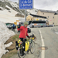 Cycling alongside the Grand Union Canal
 5 Essential Items to Take with You on Your First Cycling Tour
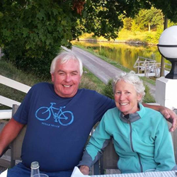 Favorite Cycling Destinations: Sardinia
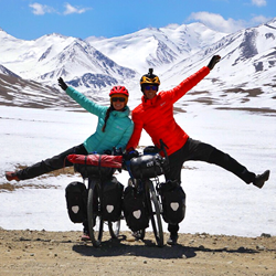 Pamir to Karakoram- cycling the highways on the roof of the world
 4 Wheels 2 Hearts 1 World - A Day in Our lives
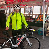
 Koga E-Worldtraveller - e-bike review
 Ten tips for tandem cycle touring
 colmandsamstreks - Two Beginners in France
 Cycling in Belgium
 Unfortunately Belgium has had some bad press about being boring, with people thinking only of Belgium for it's chocolates, Eddie Merchx and Hercule Poirot! Belgium has more to it than that and has some good cycling. From the flat lands and waterways of Flanders with the charming cities of Brugge and Gent, to ambling through the quiet rolling countryside of the Limburg and Brabant regions to the more tougher hilly areas of the Ardenne Forests in the south west where there are some steep hills to climb. The people are friendly and most welcoming, the climate is generally mild and the beer is superb!
The Limburg region is particularly well organised for cycling and the local tourist board call it the 'Cycling Paradise Limburg'.
Here is their advertising blurb:
"Imagine a place where you can cycle endlessly through amazingly beautiful nature, safe, far away from cars, across wide roads without bumps and potholes. Where people greet you amiably on the road. Where you can enjoy tasty refreshments or a delicious regional dish at a sunny outdoor cafe. Where you don't have to mess about with confusing maps and complicated directions. Where you can rest a night in a hospitable hotel while your bicycle receives some maintenance. In short, where you can be carefree and simply enjoy¦ Such a heavenly place really does exist: Cycling Paradise Limburg."
They aren't far wrong, we certainly enjoyed our tour through Limburg, there is more information on their website here.
Cycle Paths
The provision of cycle paths very much depends on which region of Belgium you are in. In the Flemish speaking north of the country, regions like the Flanders, Limbourg Antwerp and Brabant regions have very good cycle paths connecting most villages and through most towns. These are generally well thought out and separate you well from the traffic, usually on a tarmac area at the side of road and they often make good use of bridle way type tracks which generally have a very good surface. In the French speaking regions of southern Belgium we found that the cycle paths were not as well implemented and in some case non existent in towns.
Cycle Networks
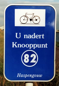
In some regions of Belgium particularly the northern Flemish speaking provinces they have now installed a system of cycle network routes known as the 'Fietsroutesnetwerk'. This is a system of marking each intersection of the cycle network with a unique number or 'Knoopunt. Signs are then placed along the route giving you directions to the next number intersection of the cycle routes that radiate from the last intersection. At each intersection there is a map showing you all the numbered intersections, once you get the hang of it, it is quite easy to navigate, you just look at the map, decide your route, note down the numbers and then follow the well marked signs. It's basically like cycling by numbers!
 Cycle Network intersection sign |
 Cycle Network direction sign |
Cycle Routes
There are various long distance cycle routes that criss cross Belgium and they appear to organised by region. There are the Lange-afstand Fietsroutes ("LF") in Flanders and the Flemish speaking regions. These link in with the Dutch LF routes, there is more information on the 'Grote Routepaden' site but unfortunately it is in flemish. In the French speaking provinces there are the Rando-Vélo a network of cycle routes in Wallonia. These RV's use quiet roads and RAVeL (Réseau autonome des voies lentes) traffic free tracks to connect the major towns. They are of average to long distance routes and are marked with yellow and blue signs. More details on the Rando-Vélo website. There is an interactive map of the RAVel routes here.
Campsites
The campsites in Belgium tend to organised by region with regional guide books available in the local tourist offices. They are mainly large sites with static caravans and a small area for tourers. Like the UK they all vary in standard, with some having a star rating which seems to have little significance to what is offered. We found most sites were very clean and well organised, although there were some that left a little to be desired. Price varied between the sites and again had no significance to star rating or to what was offered. There is information on some of the Belgium campsites on the www.camping.be and the www.campingo.com sites.
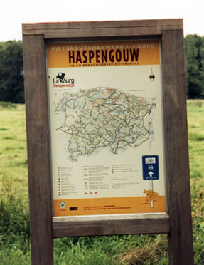
 Fietsroutenetwerk maps
These are the Fietsroutenetwerk maps issued by the regions that have the cycle networks. This one is from the Limburg region network and is at a scale of 1:65,000. The network points are well marked and the map is accurate and could be used to navigate without using the cycle network points. It includes the usual tourist information which is clearly marked on the map, as well as accommodation,campsites, cycle cafes and places of interest.
The map comes with two small information booklets one giving information on all the local attractions. The other one explains the cycle network and gives more contact detail on the accommodation, campsites and cycle cafes marked on the map. Our copy was in Flemish and German, however we found it reasonably easy to work things out from the symbols used. The pack came in a handy plastic wallet which included a credit card size card which gives a discount to some of the local attractions.
We found the accommodation information very useful on one occasion as we had under estimated the time it would take to get to a campsite and used the accommodation list to find a B&B for the night.
 Geocart Fiets Cyclotouriste Carte & guide
These are of a scale of 1:135,000 and are designed with the cyclist in mind. They do have the usual tourist information and campsites marked. They have the long distance RV's marked and where they cover the areas where there is a Fietsroutenetwork these are marked as well.
What is a little confusing is that the maps also mark circular mountain bike routes or day rides. These have route descriptions in a companion booklet which includes clearer individual maps often at a smaller scale. However these routes are not signposted therefore you must use the guide to follow them.
These maps and guide could be quite useful if you are based at a point and wanted routes for day rides. The mapping and scale of these maps are the same as the 'De rouck' maps but I preferred the 'De rouck' maps as they were clearer to read due to the colours of the roads being marked.
 'De rouck' carte de province maps
These are basic 1:135,000 road maps produced by de rouck geomatics they cover the whole of Belgium and are available from most book stores. They have all the usual tourist information marked but no information on any cycle routes.
There is a small booklet attached to the cover which has a list of most places of interest, museums, castles, parks, windmills etc. Details with contact information on youth hostels, and campsites and a place names index.
As I said above about the Geocart Fiets maps, they use the same mapping but these maps seem clearer to read as the A and B roads are marked with red and yellow respectively.
If you are not using the RV routes then these are reasonable for cycle touring, although personally I prefer a map with a bit more detail.
If you are cycling in Brussels there are some cycling maps that you can download and print out here.
For GPS users there is a Benelux OpenStreetMap for Garmin available here.
Guides
The Rough Guide to Belgium & Luxembourg - Published by Rough Guides ISBN 1858288711 A very useful guide to all things in Belgium & Luxembourg.
The Lonely Planet's Belgium & Luxembourg Travel Guide - Published by Lonely Planets ISBN: 9781741042375 A very useful guide to all things in Belgium & Luxembourg.
Cycling the Netherlands, Belgium, and Luxembourg (Bicycle Books) (Paperback) by Katherine Widing
Shops
Shop opening times seem very similar to Holland, most large supermarkets were open from 8.45 until 19-00 with some open until 20.00. Some shops were only open from 13.30 - 18.00 on a Monday. Saturday opening was generally 9.00 - 18.00 and Sunday opening was from 9.00 - 12.00.
Trains
Although we haven't needed to use the Belgium rail system, I understand that it is perfectly feasible to take a bicycle or tandem on most Belgium trains. There is a very useful page on the SNCB web site here in English that explains what you need to do.
Things to watch out for & note
- Running down the side of most Belgium roads is a rounded gutter used to remove surface water. It is sometimes uneven so take care when crossing the road at junctions that you don't catch your wheel in it.
- Beware that many Belgium drivers aren't very courteous when it comes to touring cyclists. They lack patience and are not prepared to wait behind you on busy roads. Several times drivers have overtaken us when there has been on coming traffic or on blind bends, often causing the oncoming traffic to brake hard or be forced off the road. If it is a busy road you might find it safer and easier on the stress levels to considered finding a quieter route such as the RV's or the 'Cycle Network' cycle ways.
- Fresh milk is nigh on impossible to buy in the local shops and is only available in the largest of supermarkets. Belgium people seem to prefer UHT milk which they mainly use for cooking. Unfortunately even with the semi skimmed variety it doesn't make very good tea!
Getting to Belgium from the UK
There are numerous ways to get to Belgium either by Ferry or plane, it very much depends on where in Belgium you wish to go. Here are a few links that might help you.
Ferries
- Superfast Ferries - Ferries from Rosyth to Zeebrugge.
- Norfolkline - Ferries services Dover to Dunkerque.
- P&O - Ferries services Hull to Zeebrugge.
Tourist Information
There is a Tourist information Office in most of the major towns and cities. They have information on places of interest in their local area.
- Brugge Tourist information
- de Kust - Information on the coastal area of Belgium.
- Toerismelimburg - Information on the region of Limburg.
- Stad Antwerpen - tourist information on the city of Antwerp.
General Information
- Cycling Belgium's Waterways Dan Gambers excellent site on cycling along Belgium's canals and waterways.
- Cycling in Brussels - Good links and information on cycling in and around Brussels, with downloadable cycle route maps. Unfortunately it is only in Flemish and Dutch but google can do a reasonable translation.
- Belgian Tourist Office - Official website, click on the 'Transport' link for cycling information.
- Cycle hire - Some Belgium railway stations offer bicycles for hire and train and bicycle hire deals.
- fietsroute.org - Biking and cycling in the Antwerp, Limburg, East-Flanders, West-Flanders, Flemish-Brabantregions of Belgium. Good information on the regional cycle routes with downloadable route descriptions, unfortunately not all the pages are translated into English as yet.
- The Map shop, 15 High Street, Upton-upon-Severn, Worcs. WR8 0HJ England
Tel: 01684-593146 Fax:01684-594559