


 The Celtic Cycling Circle
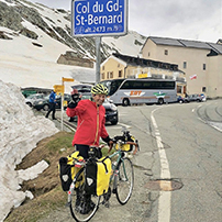 Cycling alongside the Grand Union Canal
 5 Essential Items to Take with You on Your First Cycling Tour
 Favorite Cycling Destinations: Sardinia
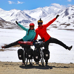 Pamir to Karakoram- cycling the highways on the roof of the world
 4 Wheels 2 Hearts 1 World - A Day in Our lives
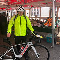
 Koga E-Worldtraveller - e-bike review
 Ten tips for tandem cycle touring
 colmandsamstreks - Two Beginners in France
Norway 2015 - The 'Mjølkevegen' & 'Numedalsruta' Tour
Part 2 - Beitostølen to Kongsberg
15.08.15 - Beitostølen to Vang
 It was a beautiful morning and fortunately Frank was feeling a lot better. The tent didn't take too long to dry and with everything packed we were off. The gentle incline of the cycle path eased us in but even after our usual 2 mugs of tea for breakfast Frank was still thirsty so we were soon stopping at a bakery cafe in Beitostølen for coffee and a vinabrot which given that I rarely drink coffee was actually quite nice. We hadn't got far out of Beitostølen when we came across our first cache. I won't say too much about this cache so as not to give the game away but it was a cunning hide that had us foxed for awhile. Finally we got going again only to stop about 600m further on for another cache. We pulled in at the bend and left the bikes just off the road. Frank found some lovely orchids to photograph whilst I had a look for this cache. I found the little trail to the little bench and the lovely view and started searching. I was soon joined by Frank and we searched and searched all over the place. I was about to call a DNF but Frank said 'no another 5 minutes' (she just doesn't like to be beaten by a cache). It was soon after that that we spotted this brilliantly clever cache.
We noticed that there was another cache only another 600m further on by the same CO and although we had spent a lot of time on these caches we couldn't resist trying to find this one as well as they were so good. We parked up our bikes at the suggested parking spot and looked for a way to this cache. There was a track but it led to a house. Frank thought she could see a bit of a path through the Birch scrub which turned out to not be a path at all and we ended up hacking up the hill through deep undergrowth and tree brushings. Eventually we got to GZ and the lovely view point and then the fun started. We won't say any more than to say it was well worth the aggro of the climb up [:D]. But if you are going to tackle this cache it's best approached via the road up by the new cabins.
We really had to get going as it was now nearly 2.30pm and we were only a couple of kilometres from Beitostølen. Fortunately there weren't many more caches on our route. The road went downhill until we got to the 288 where we turned right to head into Rauddalen. At Øyang we stopped at a shop to buy some drinks and whilst Frank was doing that I looked for a cache that was just around the back, fortunately this cache was quite easy to find and we were soon back on our way. It was quite a nice ride through the farms and hay meadows on the side of the Rauddalen valley. At one point when we stopped for a short rest Frank got stung on the back of the leg by what must have been a wasp which was very painful! We soon came to the end of Rauddalen and the tarmac road near the bridge over the river gave way to a the gravel road. This would take us up on to the Slettesfjell. It was getting late in the afternoon so I suggested that we stop and have a brew and something to eat as we hadn't had anything to eat since the vinabrot at Beitostølen. Hopefully it would give us some energy for the climb and boy did we need it as the gradient increased and we were soon again in the granny gear with our hearts pumping and breathing heavily as we climbed from 750m to 950m. The trees soon gave way to open scrub and although it was hard work we were soon at the dam at the mouth of the Fliensendin lake and the views were tremendous across to the snow capped Jotunheim mountains. This was only part way up and we still had a long way to go to get to the Slettesfjell summit. The next section from the lake had a short steep section initially but then contoured in a diagonal line at an easier gradient to a little flat section where we could see a newly built wooden building and when we got close to it we could see that it was a cafe with tables and benches outside with cows milling around. We pulled into the ‘Mugnetind Kafe’ to have a look. It was just before 6 o'clock and there were only two people there but we seemed to start a trend as within minutes several cars had stopped and the place was heaving with people. The guy said that they were going to shut at 6 0'clock but this was the best crowd they had had all day so they decided to stay open. They were cooking ‘Kvitkako’ on a large hot plate, it is a type of pancake made from barley flour and sour cream which they served with sour cream (which seemed to us to be like yoghurt) and strawberry jam. What was funny were the cows that were milling around they seemed to have a liking for our bikes, they kept head butting the panniers and trying to eat the pannier straps. One of them nearly had my bike over and one took a liking to Frank's Brooks saddle trying to eat it, we just hoped it wasn't a relative! I had only just put our coffees down on one of the tables when one of the cows bumped the table and spilt our coffees! Frank got talking to a couple from Oslo who turned out to be both teachers and the woman also worked in special education and she had relatives who lived near Cambridge, it's a small world!
Suitably refuelled with the pancakes and coffee we just couldn't put off the final climb up to Slettesfjellet any more so we said our goodbyes to the couple from Oslo and headed up the gravel road. Initially it was of a reasonable gradient with a little flat section in the middle but as we got closer to the summit it kicked up a bit in gradient and there were a couple of points where Frank had to get off and push. As we looked back there were tremendous views looking across to the snow capped Jotunheim mountains. Eventually we made it to the summit and the views were amazing as the skies to West were just black threatening clouds which looked angry and we thought surely they must contain rain, we had been looking at the weather forecast and it reckoned on rain for the night and the next day. We decided to put on our fleeces and a waterproof on for the next downhill section as it was getting a little chilly. And boy was it a good downhill, even though we had our Magura hydraulic brakes we still had to stop half way down to give our hands a rest and cool the rims down a bit although with it being a gravel road you just couldn't let the bike run as the surface was just a bit too loose in places. We soon met the 293 and carried on down the 289. We had intended to take the 302 down to the E16 but we were so enjoying the downhill that was on good tarmac that we must have missed the turning. When we got to the E16 just over the bridge and turned right I did wonder if we were correct as we came to a tunnel where Ala camping was supposed to be. I checked the GPS and realised what we had done. Frank was a little tired by now and wasn't that happy to be going on any further but I persuaded her that it was better to go on to Vang camping rather than go back to Ala camping as it would be less distance to do the next day. Fortunately there was little traffic on the E16 and as it was getting dusk we put our lights on. We got to Vang camping at about 8:30pm, as we pulled into the campsite a young lady came out of the main reception building to greet us. Are you looking to camp or would you like a hut? Well as it was very late and as we were both fairly knackered and it looked like rain we went for the hut without question.
| Click on the thumbnail images below to see a larger version in a pop up window |  |
 |
 |
 |
 |
 |
 |
 |
 |
 |
 |
 |
 |
 |
 |
 |
 |
 |
 |
 |
 |
 |
 |
 |
 |
 |
 |
 |
 |
 |
 |
 |
 |
 |
 |
 |
 |
 |
 |
 |
 |
 |
 |
 |
 |
 |
 |
 |
 |
 |
 |
 |
 |
 |
 |
 |
 |
 |
 |
 |
 |
16.08.15 - Vang
The forecast wasn't good so we decided on a rest day as climbing up the Slettesfjell yesterday had really knackered us. It didn't help but Frank found the bed although a ‘put you up’ really comfortable. The threatening skies of yesterday evening only gave rise to overcast skies and the rain never materialised. So I rode up to the main part of the village to see if the Co-op was open but as we suspected it was closed as it Sunday. We ended up having a burger and chips from the garage across the road from the campsite.
 |
 |
 |
 |
17.08.15 - Vang to Søre Syndin
It was a beautiful sunny morning and as we were well rested we were raring to go. There is one good thing about staying in a hut and that is that it doesn't take so long to pack up. Fortunately for once it wasn't straight up from the campsite and we had the 4kms along the cycle path to warm up before we turned off the E16. Unfortunately it was a little steep to start with but fortunately after climbing 80m in height there was a turnoff to the left and right track eased in gradient to a series of zigzag sections through the meadows. There were lovely views through the trees looking down the valley and it was hard work on the legs so we did it in short bursts the steepest part was between 700m and 850m where we stopped just after a gate across the track for some lunch. The section after that was was through trees and birch scrub which wasn't quite so steep but at 950m there were a lot of false summits. Eventually we hit the highest point and there was open moorland with small snow capped mountains behind. From the highest point we dropped down to the Nødre Syndin lake where we had to cross the river that flowed out of it. Our friend Stan had mentioned this to us when we had a Skype call just before we left the UK. We stopped and popped on our Teva sandals and I checked it out. The crossing was only really ankle deep and didn't come up to the height of the bottom brackets so we waded across with the panniers still on the bikes. It wasn't quite like some of the river crossing that we have had to do in Iceland, the water was certainly much warmer. Once we had dried our feet and got our cycling boots back on we found a nice spot on some smooth rocks by the side of the lake where we stopped and had a lovely cup of tea and a snack, it was an absolutely beautiful spot.
The next bit of the track was a bit tricky and we had been warned by Stan and the guy from Vang campsite that this part wasn't easy to cycle. The track was narrow and rocky with some parts muddy and rutted. Certain parts you could ride OK with care but on certain parts it was easier to get off and push the bikes. At one point there were deep ruts made by tractors and Frank tried to ride through them but got her pedals caught in the ground either side. Fortunately the track didn't go on for too long and we were soon back on a gravel road and in amongst the summer houses. Our route climbed a little above the lake and then down to cross the little river that joined Nødre Syndin with the Søre Syndin lake. It was there that we met two women cyclists they must have been cycling hard as they were just wearing cropped tops and we were wearing windproofs. We stopped off near a dried-up river bed to find a cache and continued on to the side of the Søre Syndin lake where we started to look for a water source and a place to camp. Just by the side of the road we spotted a pipe with water rushing from it. It looked clear and free flowing so we judged it was a supply from a spring, but we always boil our water just to be on the safe side. Soon after finding the water we soon spotted a good little camping spot just off the road above the lake. We managed to get the bikes down off the road and with a little jiggling managed to get our tent pitched for a comfortable night's sleep amongst the rocks and heather on a little grassy bit. With the tent up Frank started inflating the Expeds and I got the stove on for a well earned brew. Whilst we were cooking our evening meal we were treated to a lovely sunset. It had been a tiring but lovely days cycling.
| Click on the thumbnail images below to see a larger version in a pop up window | |
 |
 |
 |
 |
 |
 |
 |
 |
 |
 |
 |
 |
 |
 |
 |
 |
 |
 |
 |
 |
 |
 |
 |
 |
 |
 |
 |
 |
 |
 |
 |
 |
 |
 |
 |
 |
 |
 |
 |
 |
 |
 |
 |
 |
 |
 |
 |
 |
 |
 |
 |
 |
 |
 |
 |
 |
 |
 |
 |
18.08.15 - Søre Syndin to Oset
It was a beautiful morning and there was a lovely mist on the lake with hardly a breath of wind. We were expecting to be plagued by mosquitos but there were hardly any about. As I prepared breakfast it was obvious that we were at an altitude as the unopened packet of Honey Smacks looked like it had been vacuum packed. It didn't take long to pack everything up and we were soon back in the saddle. It was nice to ride down the Johmsvegen from our campsite for a change as it is usually uphill! Whilst we had been planning this trip I had downloaded a gpx file for the phone and GPS's showing the route of the Mjølkevegen. I had noticed that at a point just about half a mile down the road from our camping spot the gpx route showed that the Mjølkevegen route went straight up the steep mountain side. We thought it must be wrong but you can never be sure. We were glad to find when we got there that the route was indeed wrong and it went the way that I predicted it would where we would turn off left from the gravel road onto a track. The track turned out to be a narrow track which was very rocky and muddy in places, it obviously wasn't used by many vehicles. It took us for about a mile through some birch scrub and then through some open moorland. With care we could ride most of it but there were parts where it was safer to get off and push. We were soon at the little farmstead at Trønastølen where we joined the Jaglangvegen which was a wide gravel road. A little way on we reached the junction at Solvollstølen where we took the Muckelivegen which took us further down the valley towards Våsetvatnet.
It was a lovely sunny morning and most of the route was downhill which made a welcome change although there was a little climb up Raundokkstølen having crossed over the Rassvæta river. We were soon down by the side of the Våsetvatnet and it was easy going on the flat. When we reached the main road at Våset we decided to try and find something for lunch. We had a decision to go left or right and I had a hunch that we might find something going left even though it wasn't on our way. Fortunately I was proved right as we found the Sekskanten diner about 300m down on the left. The place was empty but there was a lady in the kitchen who came through to meet us. I asked her if she could do us something for lunch. She said she could do us bacon and eggs with fried potatoes for lunch. We seemed to start a trend as several people came in to eat after us. Suitably fed and watered we set off again. The first part up the Panoramavegen wasn't too bad but when we turned off the main road on to the Valtjednvegen it was a SOD of a climb out of Våset. We were back to our usual routine, we would cycle as far as we could up the hill and then rest before tackling the next bit. It was a wide gravel road through some rather uninteresting birch scrub with few wild flowers or a good view to distract us. Eventually we got to the top at and we were glad to find the Gomobu Fjellstue where we stopped for some waffles and coffee, which were most welcome. The route on from there was fairly flat which was a relief and we crossed open moorland with several small lakes and bog passing the Graneistjernet lake. We stopped at the Valtjern kiosk which wasn't open so we nipped down the little lane to its right to find a cache which was only a few 100m away.
From there we skirted around the bottom of the Valtjernknatten 1060m through Valtjednstølen with a good view over the Valtjernet.at Brattåsen we had a choice of routes as the Mjølkevegen was signposted in two directions they both ended up at the same place at Furuset. We decided to go via the road that went past the Gauklitjernet lake as there was a cache that we could find en route. It was a lovely evening and there were some wonderful clouds in the sky. When we got near to the cache we realised that we would have to leave the bikes by the side of the road and head across the moor to find the cache. It was a bit of a trek as the heather was deep in places and there were some boggy parts that we had to skirt around. It was worth the trek as the cache was next to a stone marker that was similar to the Ordnance Survey triangulation pillars we have in the UK it was a marker for Baseline Tisleia East survey. Having successfully found the cache we headed back to the bikes and carried gently downhill to Gaukelii where we then skirted around the Gaukelitjednet lake and then climbed up through the forest and then down to Furuset. At the junction there was a wee little cache that didn’t take too long to find. It was starting to get late so we decided that we had better find a place to camp. My friend Stan had said that there were probably some places to camp near the Tisleifjorden lake so headed there. When we got there the Tisleifjorden is used as a reservoir as there is a large dam at the southern end which we crossed over rather than drop down on the road and have to climb up the other side, it gave us a good view of the lake. On reaching the other side at Øset we looked for a place to camp. I spotted a small path running towards the lake and found a nice little lichen spot in amongst the heather and bilberry. Whilst Frank started getting the tent up I went off to get some water, fortunately there was stream down at the end of the path not very far away.
| Click on the thumbnail images below to see a larger version in a pop up window | |
 |
 |
 |
 |
 |
 |
 |
 |
 |
 |
 |
 |
 |
 |
 |
 |
 |
 |
 |
 |
 |
 |
 |
 |
 |
 |
 |
 |
 |
 |
 |
 |
 |
 |
 |
 |
 |
 |
 |
 |
 |
 |
 |
 |
 |
 |
 |
 |
 |
 |
 |
 |
 |
 |
 |
 |
 |
 |
 |
 |
19.08.15 - Oset to Gol
Woke up to another beautiful morning which was good as we really needed to get the tent nice and dry as we would be staying with our friends Stan & Daema in Gol. While we were having breakfast a woodpecker appeared and hammered on the nearby telegraph pole, unfortunately it was just on the wrong side of the pole to get a good photo. We stretched the tent out on the heather and made sure that it was crispy and dry before packing it away. Just up the road from our camping spot was the lovely Stave church at Oset. We stopped to have a look at it, sadly it was closed as we still haven’t been able to see inside one of these Norwegian stave churches. From there we climbed up to Ørterstølen where we stopped at the Fjellstove to have some lunch. The owners didn't speak English and seemed east European in origin. When I asked the lady to explain what one of the things was on the menu, she put her hands above her head indicating antlers so we guessed it was reindeer so we decided to have that and it was indeed a lovely reindeer stew with carrots and rice.
Fortunately that was most of the climbing completed and the gravel road took us through farmland with grazing cattle and then into forest before bringing us out on to the 51 which was the main road down into Gol. We briefly stopped at the junction to pick up a cache before heading off for Gol our destination for the day. It seemed quite strange being back on tarmac after all the gravel roads that we had been on the Mjølkevegen. It was a good ride down to Gol apart from the odd idiot that couldn’t wait to overtake us just before a bend and only just missed the car coming around the corner. Before we knew it we were in Gol where we stopped to buy Stan & Damae some flowers and a bottle of wine. Well that wasn’t easy as I asked the guy in the flower shop. Oh he said you can only buy wine at the government licenced store in town. It is ridiculous he said I bet you don’t see english people rolling around in the street drunk all day. Having finally bought the wine we headed off to find Stan & Damae’s house. It was so nice to finally meet up with Stan & Damae, we have been conversing via e-mail for several years after Stan e-mailed me concerning a question about the Rallarvegen.
| Click on the thumbnail images below to see a larger version in a pop up window | |
 |
 |
 |
 |
 |
 |
 |
 |
 |
 |
 |
 |
 |
 |
 |
 |
 |
 |
 |
 |
 |
 |
 |
 |
 |
 |
 |
 |
 |
 |
 |
 |
 |
 |
20.08.15 - Gol
We spent most of the morning chatting to Stan about all sorts of things mainly about cycle touring and later we had go on his and Damae’s Rolhof equipped touring bikes which was great as we had always wanted to try Rolhof gears. In the afternoon Frank and I explored the area around Gol where we did a few of its caches and the road up to Gol Kirke. At Gol Kirke we saw the spot where the old Gol stave church used to be. Apparently when the locals decided in 1880 to build present new church they were going to destroy the old one. Fortunately it was saved and was reconstructed and is now in in the Norwegian Museum of Cultural History at Bygdøy in Oslo. When we got back Stan had to pick up a parcel from the Post Office so we went down in his Citroën Dyane. Well my first ever car was a Dyane and when I found out that Stan had one he promised me a ride in it. Well it was brilliant we put the roof down and set off. Well the noise of the engine and the jaunty road holding brought it all back, it was just like being 22 again. Why on earth did I ever sell that car, I wished I still had it.
| Click on the thumbnail images below to see a larger version in a pop up window | |
 |
 |
 |
 |
 |
 |
 |
 |
 |
 |
 |
 |
 |
 |
 |
 |
 |
 |
21.08.15 - Gol to Nesbyen
We said our goodbyes to Stan, Daema and little Odd Egill and headed off to find the railway station. Stan had suggested that we take a track that started at the station and ran alongside the railway as it was a better way to get to Nesbyen rather than hacking down the fv7 with all its traffic and lorries. It was a gravel track that obviously served the local farms on that side of the valley and the only traffic we came across was the postman in his van. About halfway along it was obviously little used as it became a dual carriageway track but it was a lovely route where we feasted on wild raspberries and strawberries that lined the track. When we got to the fv7 we had a short few hundred metres on the fv7 before we turned onto the Rudvegen 216 to take us to Nesbyen. Just as we left the junction Frank spotted a grass snake on the road sadly it had been hit by a car. The Rudvegen was a fairly quiet road that followed along the route of the railway and I had a fright as I was just coming around a bend when there was a loud hoot from the train that I hadn't realised was just below me!
At Nesbyen station we stopped to find a cache before heading into town to find some lunch. We soon found a Remi store which also had a cafe so we stopped there for lunch. It was then that Frank's stomach cramps problem reoccurred. She had problems since we had at been at Vang and thought she had got over it. Fortunately there was a Boots the chemist in Nesbyen so we stopped there to see if they could suggest something for it. There was no way that Frank was going to make it up the Rukkeddallen that day as it was a fair bit of climbing so I suggested that we stop at the campsite at Nesbyen and that we stop in a hytte if it was possible as it would be much more comfortable for Frank rather than have to scramble in and out of a tent. Poor lass she seems to have had it bad this tour what with her back. When we got to the campsite there was a number to ring on the reception door. When I rang the number luckily the lady had a cabin for two available. It was quite a nice cabin as it had obviously been a hut that had previously been attached to a caravan on the site. It was quite comfortable with a large covered veranda, a double bed, sofa, easy chair and a small kitchen with a fridge and a two ring cooker.
| Click on the thumbnail images below to see a larger version in a pop up window | |
 |
 |
 |
 |
 |
 |
 |
 |
 |
 |
 |
 |
 |
 |
 |
 |
 |
 |
22.08.15 - Nesbyen
Frank's stomach cramps still weren't a hundred percent better in the morning although they weren't as bad as the day before, at least the medication that the chemist had suggested seemed to be helping. There was still no way she could comfortably ride so I suggested we had better stop another night to give the medication time to do its job. While Frank sat reading I had a cycle around Nesbyen and did a couple of the caches in the afternoon.
| Click on the thumbnail images below to see a larger version in a pop up window | |
 |
 |
 |
 |
 |
 |
 |
 |
 |
 |
 |
 |
 |
 |
 |
 |
23.08.15 - Nesbyen to Rødberg
It was a lovely morning again as we left the hut just before 11.00 not the earliest of starts but we weren't sure how Frank was going to be, she reckoned that she was a lot better. We nipped into the Kiwi to buy something for our tea as we weren't sure if we would get to Rødberg that night or find a shop open as it was Sunday. It was a bit of a pull out of Nesbyen up some hairpin bends, but we were both pleased with ourselves as we both got up it in second gear, either we were getting fitter or the gradient wasn't as steep as we thought. Fortunately after the initial steepness of the hairpins it was less of a gradient for a while as we steadily climbed up through trees and hay meadows which almost had an alpine feel to it and as ever we had the burbling river running alongside the road most of the time. It was a beautiful day with hardly a cloud in the sky which meant it was quite hot in the sun and we had to keep looking for a shady spot to stop for a drink. There must have been a classic car rally on somewhere as although there wasn't too much traffic on the road we kept being passed by old classic cars a lot of them were old American cars such Dodge Chargers, Corvettes and old Chevrolets. When it was getting towards 2.00pm I suggested to Frank that we look out for somewhere to have some lunch, preferably in the shade. I saw her stop up ahead of me and she had spotted a nice log cabin style bus stop which was just perfect.
It was quite a long way up Rukkedalen and we seemed to be climbing for ages and with the heat it was a little exhausting. Eventually at 825m the road started to flatten out and we caught sight of the Synstevatn which feeds the Rukkedøla river which we had been following all the way up the Rukkedalen. The road took us out of the main forest into birch scrub as we got to the Buvatn, but on leaving the lake side we were back into deep forest as we climbed the last climb up to the junction with the 120. We knew that was most of the climbing done and that it would be downhill to Rødberg. It was a lovely evening as we cycled along the Tunhovdfjorden which is the main reservoir for the hydro plant at Rødberg. We were soon cycling across the dam at the southern end of the Tunhovdfjorden and with only a little climb up from the dam we were soon on the descent into Rodberg. It was a cracking descent down numerous hairpins until we were soon alongside the hydro plant arriving in Rødberg just after 7.30pm. After a quick visit to the Kiwi store we headed off to find the campsite. We had decided to hire a hytte if we could as it was late. There is only one problem with Rødberg and that is the noise of hydro plant, it is fairly loud even though we were the other side of the lake. Fortunately we were both so tired after our cycle that we were both sound asleep as our heads hit the pillow.
| Click on the thumbnail images below to see a larger version in a pop up window | |
 |
 |
 |
 |
 |
 |
 |
 |
 |
 |
 |
 |
 |
 |
 |
 |
 |
 |
 |
 |
 |
 |
 |
 |
 |
 |
 |
 |
 |
 |
 |
 |
24.08.15 - Rødberg to Holman Camping
We were quite glad that we were in the hut as it meant that we could get away earlier. It was a lovely morning as we headed off down the FV40. Initially there was a cycle path for a few miles out of Rødberg but it soon petered out and we were back on the road. The traffic was quite light so it didn't matter and it was quite a change cycling on the flat. We were soon passing the lovely Skjønne Kyrkje with its white painted sides and its slate grey roof, it looked rather stunning in the sunlight. The road from there follows the the side of the Norefjorden and at its southern end we went through the Rustandtunnelen which is a very short tunnel and I stopped to take a photo for our tunnel map. We turned off the FV40 and on to the Fv116 at Nore to follow the Numedalsruta. At Nore we stopped to look at the church and we rather liked their glass recycling hut which was very nicely disguise as a small barn. It little way on we came to the Nore stavkyrkje. It was in the process of being renovated with a new roof. I spoke to one of the roofers and he said they had been working on it for 2 months. As we were about to depart a chap came along and pronounced that he had the key and would give us a guided tour of the inside. We were so lucky he came along as we have always wanted to have a look inside one of these Stave churches, it was fascinating inside and half reminded me of the inside of some of the Buddhist temples that we had seen in Ladakh being dark and wooden with big post beams.
From there we followed the western shore of the Kravikfjorden through forest with hay meadows on every flat piece of ground. There were some lovely barns and old buildings at Nordre Frygene. A little further on were the burial mounds at the Frygne Gravfelt. There was also a lovely old barn at Nordre Kittilsland. When we got to the end of Kravikfjorden we found a lovely little place at the edge of the lake for a brew stop and while we there we were entertained by a pied Wagtail that flited around the rocks on the lake shore.After crossing the bridge over the Kravikfjorden at Kravikfjord we were only back on the Fv40 for a short time when we turned off at the end of the Kravikfjorden and took the Fv109. All the way along the valley is the Numedal line which is mainly disused and we crossed it at the small halt at Fossebrekke. It was a scenic route however it unfortunately involved a few hills which was a bit tiring. It was starting to cloud over and by the time we got to Mykstu it had started to spit with rain and as we got to Veggli it really did start to rain so we sheltered in the porch of the Veggli kirke to put on our full waterproofs. It was a short run down to the center of Veggli where we soon found a Rimi supermarket where we could stock up on food. While we were paying I asked the assistant if the Holman camping site was still there and she said it was and it wasn’t too far down the road which was a relief as we were both getting tired and didn’t really fancy adding to our miles that day. Although it was coming down in stair rods we were both well kitted out and grateful to see the sign to Holman camping. Fortunately the chap at the campsite had a hut available which was great, we decided to pay extra for one with its own shower and toilet which was much better than having to trek down to the showers in this downpour.
| Click on the thumbnail images below to see a larger version in a pop up window | |
 |
 |
 |
 |
 |
 |
 |
 |
 |
 |
 |
 |
 |
 |
 |
 |
 |
 |
 |
 |
 |
 |
 |
 |
 |
 |
 |
 |
 |
 |
 |
 |
 |
 |
 |
 |
 |
 |
 |
 |
 |
 |
 |
 |
 |
 |
 |
 |
 |
 |
 |
 |
 |
 |
 |
 |
 |
 |
 |
 |
25.08.15 - Holman Camping
I woke early to the sound of rain, it was what we had expected but this was rain that was coming down in stair rods. As I lay listening to it I checked the forecast on my phone and it forecast for the rain to stop overnight and for it to be better the next day. As we had a day in hand we could afford to stay another day and ride down to Kongsberg tomorrow as long as the campsite owner said we could stay another day. We had some breakfast and I gave him a ring. He laughed when I asked him if we could stay another day and said he didn't blame us with the weather he would have done the same in the circumstances. Well it did rain and it rained solidly all day. We sat in the hytte looking out at the river below as it rose gradually covering more and more of the rocks until it was in full spate having risen a good metre in height. It was quite peaceful sitting on the veranda listening to the new celtic folk rock group Mànran that I had just discovered by accident while searching for something else on the BBC iplayer app.
 |
 |
 |
26.08.15 - Holman camping to Oslo
Fortunately the rain had stopped and the river was still very high. We packed our panniers up and tidied up the cabin. As we left the campsite it was a little overcast but there were breaks in the clouds with the sun breaking through. From the Idrettsskolen Numedal folkehøgskole there was a cyclepath which was nice however after about a mile it unfortunately stopped. A stream in spate by the side of the Fv40.
It was a nice ride down the 40 and it was quite a change cycling on the flat through fields of crops either side of the road especially as there didn’t seem to be much traffic. We stopped at the Numedal Kro restaurant for a mid morning coffee and waffles which helped us along the way. At Djupdal the Numedalsruta was signposted to go along the Fv98 however looking at the the terrain that it covered it looked very much like the route the day before and much hillier than the main road and as there seemed to be little traffic on the Fv40 we decided to stick with the main road, it also meant we could pick up a few caches along the route. Just before Flesberg we saw a train on the Numedal line with wagons of concrete sleepers apparently the line between Kongsberg and Flesberg is being used to move timber. After a derailment in to 2014 the old timber sleepers are being replaced with concrete ones. We stopped at Flesberg as there was a lovely Stave church which had an interesting wall around it made from slabs of stone many of them had steel rings attached to them which were used by the local farmers to tie up your horse when they attended the church service. The rings had marks on them but we couldn’t work out if they were just decoration or markings to depict whose ring it was.
From Flesberg the road runs very close to the Flemsdal line through forest and we stopped several times to find several caches. It was easy cycling as we were obvious following the flowing river Lågen down to Kongsberg. At Svene we crossed to the other side of the valley and it wasn’t long before we were at the outskirts of Kongsberg and we found good cyclepaths and a cyclepath that went across the Lågen river attached to the side of a railway bridge. We soon found the railway station just as it started to rain. We had looked at the forecast which was rain for the next few days and as there was no campsite in Kongsberg we might as well get ourselves to Gardermoen a day early and make a day trip into Oslo. Unfortunately they didn’t have an available room at the Raddison Park hotel but we did manage to get one in the Raddison Blu hotel which is only a few hundred meters away!
| Click on the thumbnail images below to see a larger version in a pop up window | |
 |
 |
 |
 |
 |
 |
 |
 |
 |
 |
 |
 |
 |
 |
 |
 |
 |
 |
 |
 |
 |
 |
 |
 |
 |
 |
27.08.15 - Oslo
It rained most of the morning and we decide not to bither going in to Oslo as we had had several days there back in 2002. We didn't check out from the hotel until just before 12.00 and we wandered the bikes across to the Raddison Park hotel. As there was a queue of people waiting to book out we put the bikes under a covered way next to the hotel entrance and had a brew to use up the remaining gas. Once we had checked into the hotel Frank decided to to sit and read her Kindle while I nipped out and found a few of the caches near the airport.
28.08.15 - Oslo to Home
Our flight to Amsterdam was on a Embraer 190 and was fairly uneventful, fortunately the weather was good so we got some good views of the Friesian Islands and Holland as we landed at Schiphol. We had a bit more time before our connecting flight than we had had on the way out so we had time to get a quick drink. The flight to Norwich was again on a Fokker 70 and the good weather stayed with us which again gave us good views. Our flight path took us just to the north of Great Yarmouth so we had good views of the the town and Breydon water, Filby broad and Acle bridge. After we had landed we headed into the baggage reclaim area. Only one of our flight bags appeared and then a baggage handler chappy arrived carrying our bikes one in one hand one in the other, I was well impressed as they weight 16kg each. I asked him if all the bags were now unloaded from that flight as we were missing one. He said it was all unloaded so we had better report it was missing, which we duly did. They said it would probably arrive on the next flight which wouldn't be until the morning but they would send it on to us by courier. The unfortunate thing was that the missing bag had all the tools in it to put the bikes back together. So riding them back to my sister’s wasn’t going to be an option. Our only solution was to ring for a taxi and hope they had a minibus that could take us and the bikes to my sister’s where our car was parked. A quick phone call to a local taxi firm that we knew and it was all sorted. As we waited for the taxi we did a quick total up of the things that were in the missing bag, tent, panniers, stove, waterproofs it soon mounted up, at least if it had been lost we had it all insured. Fortunately for us it arrived at our house two days later by courier.
| Click on the thumbnail images below to see a larger version in a pop up window |
|
 |
 |
 |
 |
 |
 |
 |
 |
 |
 |
 |
 |
 |
 |
 |
 |
 |
 |
 |
 |
 |
 |
 |
 |
 |
 |
 |
 |
 |
 |
 |
 |
 |
 |
The End