 The Celtic Cycling Circle
 Cycling alongside the Grand Union Canal
 5 Essential Items to Take with You on Your First Cycling Tour
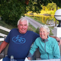 Favorite Cycling Destinations: Sardinia
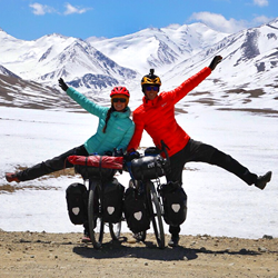 Pamir to Karakoram- cycling the highways on the roof of the world
 4 Wheels 2 Hearts 1 World - A Day in Our lives
 Koga E-Worldtraveller - e-bike review
 Ten tips for tandem cycle touring
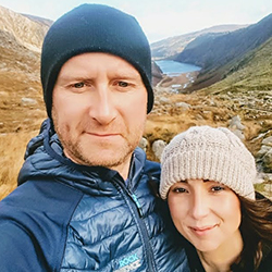 colmandsamstreks - Two Beginners in France
Shetland 2014 - The 'Irn Bru' Tour
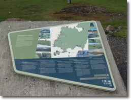
Part 2 - Yell, Unst to Esthanes |
|||||||||||||||||||||||||||||||||||||||||||||||||||||||||||||||||||||||||||||||||||||||||||||||||||||||||||||||||||||||||||||||||||||||||||||||||||||||||||||||||||||||||||||||||||||||||||||||||||||||||||||||||||||||||||||||||||||||||||||||||||||||||||||||||||||||||||||||||||||||||||||||||||||||||||||||||||||||||||||||||||||||||||||||||||||||||||||||||||||||||||||||||||||||||||||||||||||||||||||||||||||
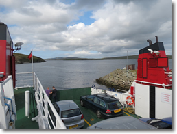
05.08.14 - Burravoe to Uyeasound
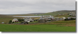
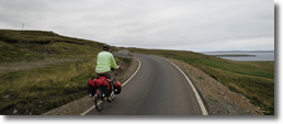
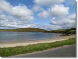
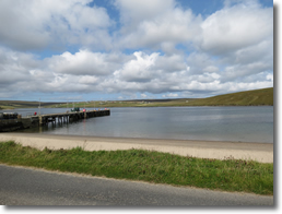
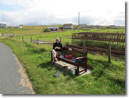
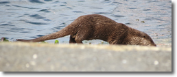
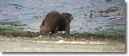
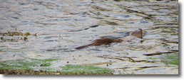
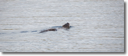
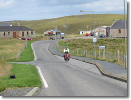
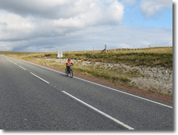
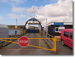
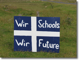
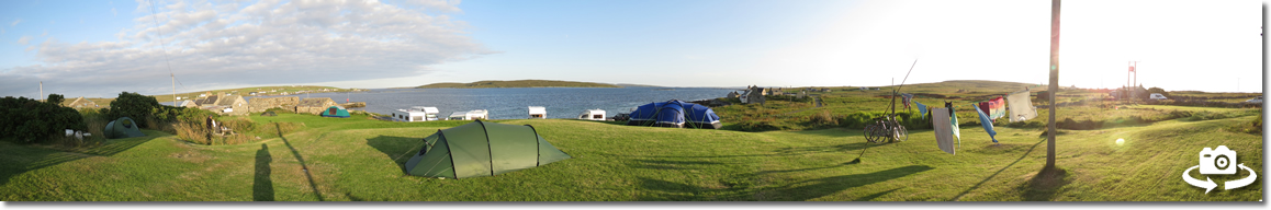
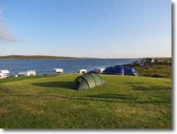
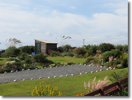
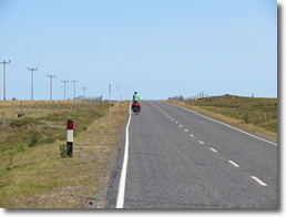
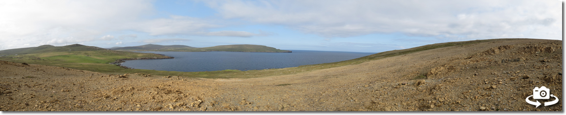
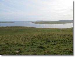
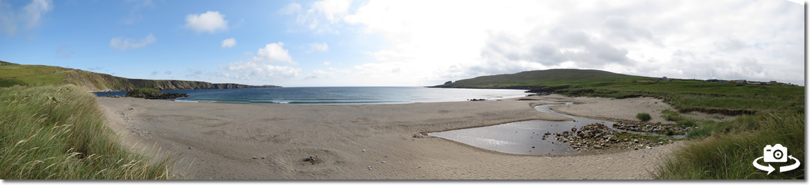
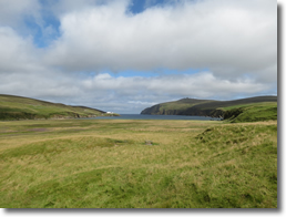
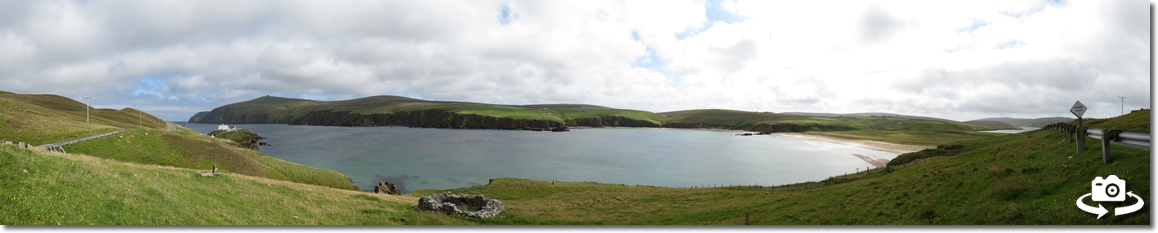
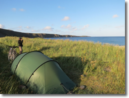
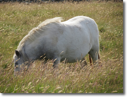
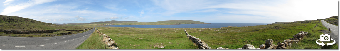
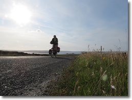
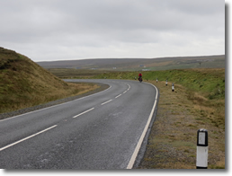
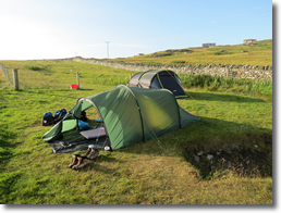
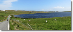
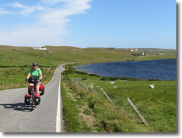
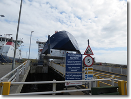
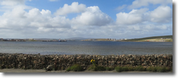
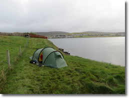
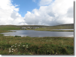
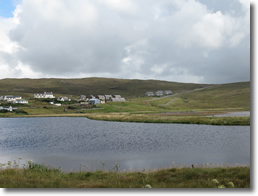
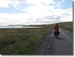
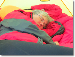
Unfortunately the shop was down by the harbour which meant a climb back up to the road to Gutcher, perhaps we should have gone by Aywick after all it may have saved us some climbing. Having stocked up at the shop we found a nice bench to sit on overlooking the beach and the pier to sit and have a brew and eat some lunch. Whilst we were having our lunch Frank spotted an Otter which crossed the road in front of us then wandered across the beach, swam to the pier and ran around the slipway before swimming off across the bay. It was probably the best view we have had of an Otter since we had seen the one in the harbour at Bodø in Norway. It was a steady climb out of Mid Yell and then down to meet the A968. The main road from there to Gutcher was fairly quiet with traffic and a bit up and down with a fair climb up over by sellafirth. It was a reasonable ride down to Gutcher. When we got to the ferry Terminal there was a ferry being loaded by it was the ferry to Fetlar so we had to wait. We got chatting to a local lady who was waiting for the Unst ferry she said we would like Unst as apart from the hill coming out of the ferry terminal at Belmont the roads are fairly flat, looking at the contours on my map she had obviously never ridden a bike on Unst as it the roads didn’t look that flat to me. The ferry didn’t take that long to get across to Belmont and we were soon hacking up the hill from loch Snarravoe towards Uyeasound. I waited at the top where there was a sign by the road ‘Wir Schools Wir Future’ We had seen several of these about Shetland. Apparently the Shetland council were trying to close down many of the outlying secondary schools on the islands and building a huge secondary school in Lerwick (which is why there there currently isn’t a campsite at Lerwick as that is the proposed site for the new high school). It didn’t take long to get from there to the turning for the B9084 and it was a good ride down to Uyeasound where we found the youth Hostel. The youth hostel has a lovely grassy area for camping overlooking Uyea Sound so we pitched the tent with the door facing the sound. It was lovely evening and having cooked our tea we sat in the hostels conservatory to eat it looking out on to a lovely view of the sound.
06.08.14 - Uyeasound to Norwick
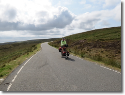
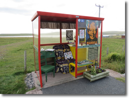
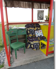
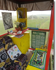
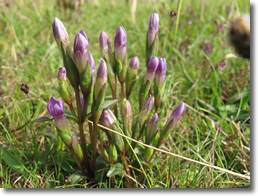
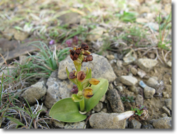
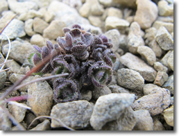
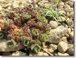
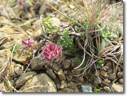
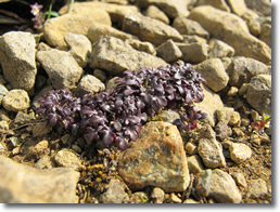
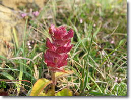
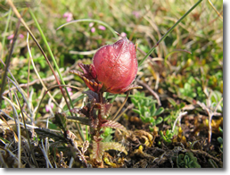
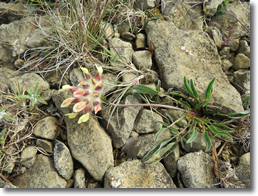
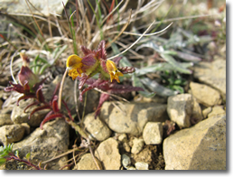
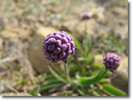
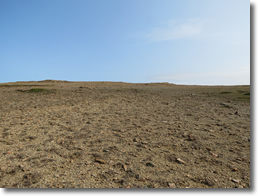
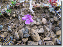
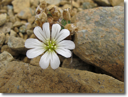
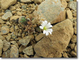
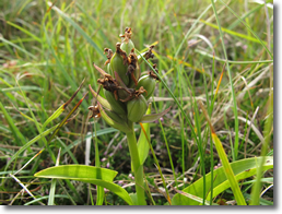
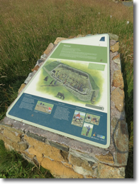
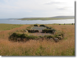
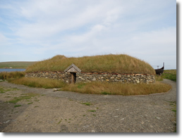
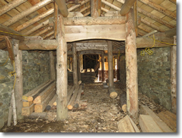
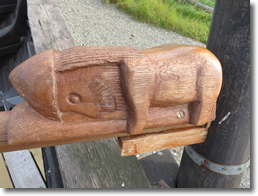
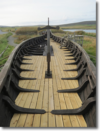
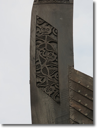
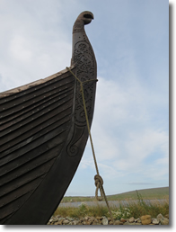
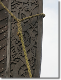
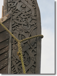
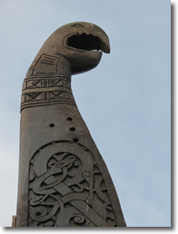
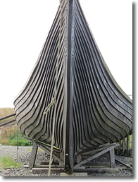
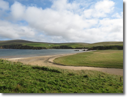
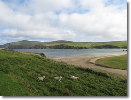
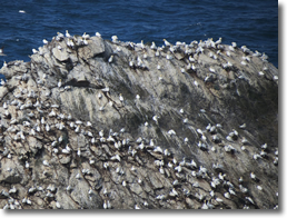
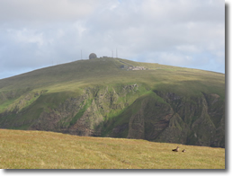
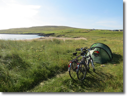
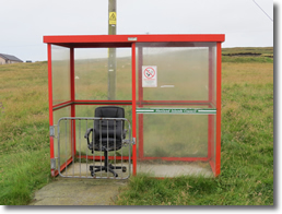
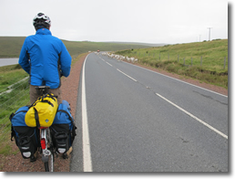
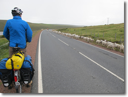
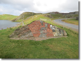
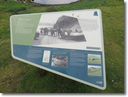
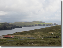
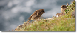
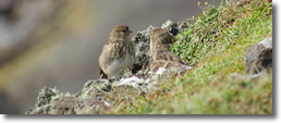
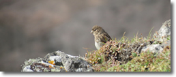
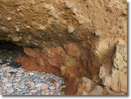
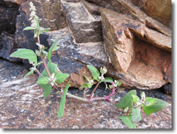
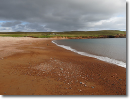
Just out of Baltasound was Unst bus shelter. We have been wanting to see this bus shelter ever since we saw it on someone's cycling blog a few years ago. It is decked out with table and chairs, and books etc. and they change the theme each year. For this year it was great to see they had chosen Nelson Mandela as the theme and it was a lovely tribute to a great man. At the junction where the bus shelter was was a sign for ‘The Keen of Hammar’ and a ‘Viking Long house’. The ‘Keen of Hammar’ was also very much on our to do list for Shetland as we wanted to see some of these rare plants. Fortunately we had a lovely sunny day and we really enjoyed ourselves looking for all the rare plants amongst the Serpentine and Harzburgite debris. The area is very devoid of vegetation due to the debris which is why the rare plants grow. It very much reminded us of the landscape in Iceland. Fortunately they had some movable information boards pointing out the rare flowers as some of them are very small and difficult to spot otherwise. Unfortunately some of the flowers were over. But Edmondson's Chickweed was supposed to be still flowering. It was out near the info board but after long walk all over the area Frank finally found one out in flower was was great as it is the only place in the world that you can find it it is that rare. We had gradually worked our way up the hill and from the top got some lovely views looking down on the Wick of Hagdale to the north and Balta Sound to the south. From there we wandered down to the Viking long house site on Swinna Ness and to be honest we weren't particularly impressed with the Viking's workmanship. If you compared it to the stonework at Mousa broch it wasn't a patch on that. Having got back to the bikes we headed over the hill to Haroldswick stopping briefly at the final checkout filling station to fill up our water container. Coming down the hill on the other side we stopped to have a look at the Viking long house and Viking ship replicas. Although the long house is finished the inside was not and was being used to store wood possibly for more buildings. I think we have been spoilt by seeing some of the wonderful Danish Viking reconstructions, they are really well done. This one certainly seemed to look like a work in progress and rather tatty with all the containers sitting outside. The Viking longship replica was good to see and it had some lovely carvings on it. It is amazing to think that the Swedes spent all that time building the replica hoping to sail it to America and they got as far as Shetland and gave up and left it there! It was getting late in the day so we started to look for some where to camp for the night. Looking at the map Frank suggested Norwick Bay looked a possibility. It meant a climb up out of Haroldswick through past Saxa Vord the old RAF accommodation which laughingly has now been called 'Saxa Vord Resort'. Apparently you can now rent the houses as holiday let's. Frank was spot on with Norwick beach it was a beautiful location and we found a nice tent sized pitch for the night in amongst the dunes.
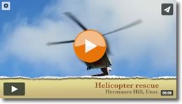
07.08.14 - Hermanes
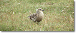
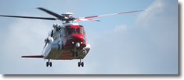
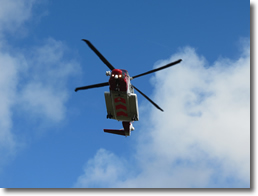
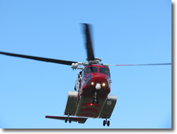
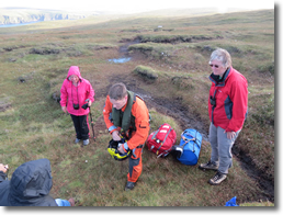
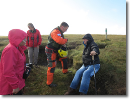
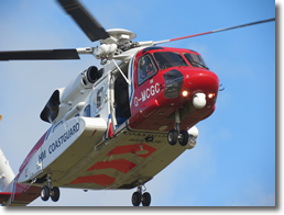
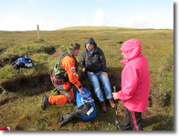
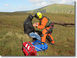
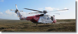
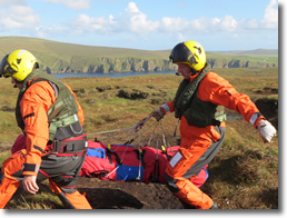
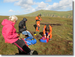
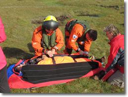
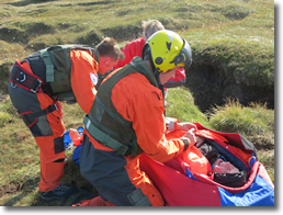
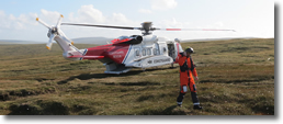
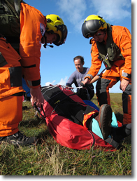
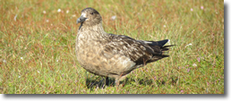
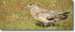
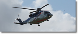
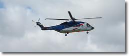
On reaching the summit the cache was quickly found and the log signed. We deliberated on which way to go back and decided that as Frank was getting tired we would take the shorter way directly back to the car park. As we headed down hill we noticed a couple going very slowly and not making much progress. On getting to them we could see that the elderly gentlemen was having extreme difficulty in walking. He was a 71 year old and was with his daughter and had slipped on a wet boggy bit and twisted his knee, unfortunately it was the one that he had had a knee replacement 18 months ago. I tried to help him down by him leaning on me but it was quite obvious that he was in considerable pain if he tried to put any weight on the bad leg. We were soon joined by his son who had come up from the car park and between us we tried to help him down but after about 50 yards it was obvious that we needed help and I suggested to his son that we called for the coast guard. Initially they were going to send an ambulance and a special constable. How that was going to help as we were a good 2 miles from the car park I don't know. Any way they finally decided to send a helicopter. Luckily it was a lovely sunny afternoon and we sat and chatted with the Terry whilst we waited. It turns out that although he was English he had married a Shetlander from Unst and knew a lot about the area and although his wife had passed away 10 years ago he still had relatives in the area. When the helicopter arrived we helped the paramedic and flight crew to get him in a stretcher and carried him on to the helicopter. It was all quite dramatic and we then walked back to the car park with his daughter and son. After saying goodbye to them we set off our bikes back to our tent at Norwick. It had certainly been a memorable day.
08.08.14 - Norwick to Fetlar
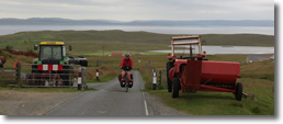
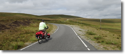
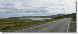
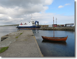
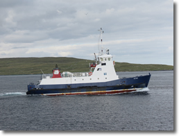
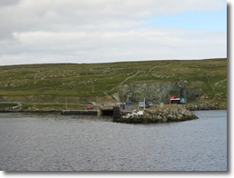
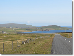
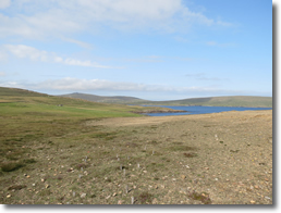
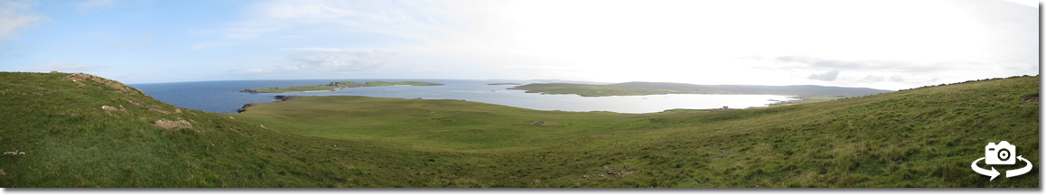
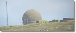
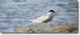
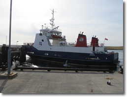
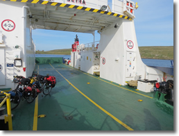
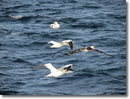
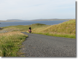
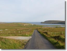
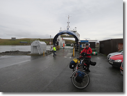
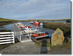
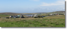
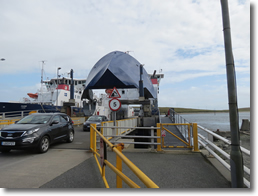
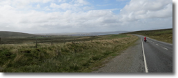
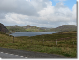
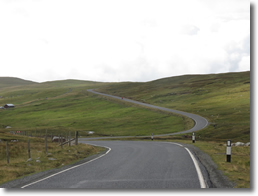
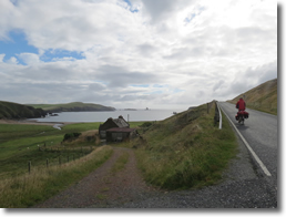
From there it was a good ride down to Balta sound and we stopped off at the shop to get some food supplies as we knew that there wasn’t a shop on Fetlar. The ride up over Caldback was a bit of a pull and we made it without too much bother. The ride down to Uyeasound was good as it was mainly downhill, we were concerned that we might miss the last ferry to Fetlar so we had to hammer it a bit and Frank suggested that I go on ahead as I was faster I could always hold them to wait for Frank. As I came around the bend on the A968 near the loch of Snarravoe I could see the ferry coming across the sound so we just in time and when I stopped at the ferry terminal I could see Frank coming down the hill behind me. Several cars came off the ferry but we were the only ones to load the ferry, it seemed like our personnel ferry with the car looking empty sept for our two bikes. We stayed on the car deck for the journey and watched gannets diving in front of the boat for fish. On arrival at Hamars Ness there were no cars waiting at the jetty as this was the final journey for the vessel as the crew moored it up for the night. As we struggled up the hill from the jetty the crew gave us a wave as they sped past at a passing place. Fetlar is quite different in some ways to mainland Shetland as it is much more cultivated and reminded us more of Orkney, it is known as the garden of Shetland. On reaching the summit of the road at Kirk Knowe we could see that the road dropped down to join the B9088 at Brough Lodge and climbed back up. There was nothing for it but the realisation that it would be bottom gear again. I stopped opposite the Ponsil mast to give Dad a ring as I guessed that I might lose coverage dropping down the otherside. Frank carried on but I saw her stop at the top of the next hill and she must have thought the same as I could see her get her phone out. With most of the climbing done we dropped down to Herra and turned off the B9088 to get to the campsite. When we got to the campsite we found that there was a sign saying that it was shut. The toilet block was locked up but fortunately there was a water tap outside that was still working. As long as we have water we are pretty much self sufficient and so decided that it was too late to go anywhere else and that we would have to camp there.
09.08.14 - Fetlar to Burravoe
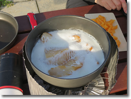
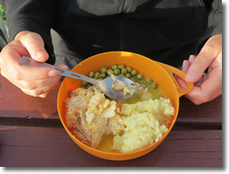
On docking at Gutcher the rain had almost stopped and I noticed that there was the Gutcher Goose cafe so we popped in for a bacon roll and a mug of hot tea, which was most welcome. The ride over to Mid Yell wasn't too bad as the gradients of the hills weren't too bad and thankfully we had a good tail wind which helped. Coming off the A970 to Mid Yell there was a bit of a steep hill and we were down to bottom gear. At the turn off to Burravoe I said to Frank that there was no point in both of us dropping down to the shop in Midyell and then climbing back up. So we agreed that Frank would carry on to Burravoe while I went down to the shop. Just as I came out of the shop it started to rain again. Initially it wasn't too much and I only had my waterproof jacket on but by the time I had got passed the corner where the Hilltop bar is it was raining quite hard so I stopped to put full waterproof gear on. It was as I put the bike on its stand that it broke! It had sheared right off near the fixing so there was no chance of fixing it. Oh well at least that stand had lasted several years, much better than some! I'm really glad that I did stop and put on full waterproofs as it rained all the way to Burravoe. Fortunately the gradients weren't too bad, the steepest part was just after the Otterswick turn off. When I got to the campsite Frank had only been there 5 minutes. Poor girl was a bit wet as she was caught by the rain as she was climbing and hadn't wanted to stop to get her waterproof bottom on. Fortunately the campsite had good facilities and it was straight into the shower for her and the waterproofs went in the tumble dryer, everything else that was wet went into the washing machine!
10.08.14 - Burravoe It finally stopped raining about 4 in the morning. I don't think between us we got that much sleep, what with the noise of the rain and the wind buffeting the tent. Fortunately that morning the wind had dropped and the sun came out. So we took the opportunity to dry all the panniers and things that were wet. We had planned on having a rest day anyway so spent it reading and sorting gear. It gave me an opportunity to sew up the zip in my other pair of cycling trousers. Part way through the afternoon the lady with her 2 kids and grandma that we had met at Levenwick arrived and we had a long chat with them. That evening just as we had got into bed the wind started to get up and it started to rain again.
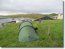
11.08.14 - Burravoe to Brae
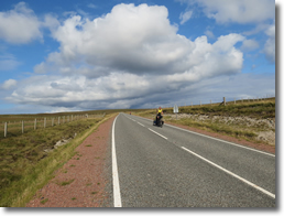
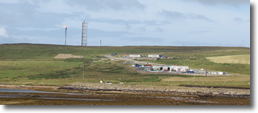
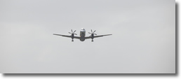
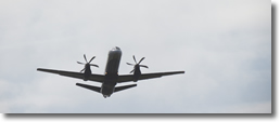
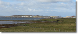
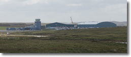
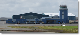
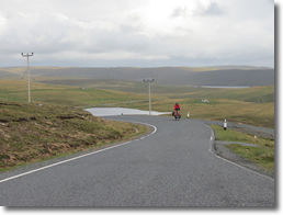
At Tofts we put a waterproof jacket on and nearly stopped to put the full set on as we caught the side of a shower but most of it past us to our left. With the wind behind us it didn't take long to get up Mossbank and we were soon on our way along the B9780 to Sollom Voe past the largest oil terminal in Europe and the site of the new Gas Terminal. Sollom Voe has its own airport at Scarta and we had to wait while they closed the road to let a plane take off. The ride to Brae was a bit up and down but we had such a great tailwind that it was almost blowing us up the hills. As we got to Brae a shower started so we quickly nipped in to the CO-OP to get away from it. However shortly after coming out we were hit by quite a heavy but short shower, we weren't going to be that lucky. The campsite at Delting Boat club was only a short distance around the corner. It mainly caters for caravans and motorhomes and there isn't much room for tents apart from a small area along the shore line. Just as we were putting up our tent we were hit by another heavy shower, we weren't having much luck in our timing. The wind was quite strong so it was a bit tricky getting the tent up but we managed without it blowing in to the sea. After our tea I popped down to the boating club to pay our camp fee as the club house didn’t open until 7.00pm. I had a good chat to the barman and the only other person in the bar who knew Suffolk well as he used to work there before moving up to shetland. I asked the barman about the weather and he laughed as he says it depends on where we were going as he can be very variable on Shetland. He said it can be cloudy and rainy in Lerwick but sunny and bright in Brae!
12.08.14 - Brae to Braewick
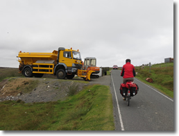
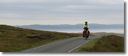
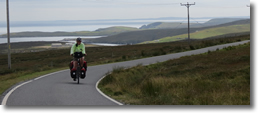
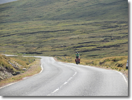
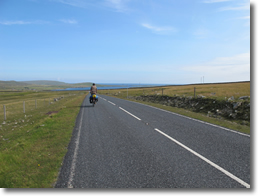
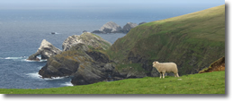
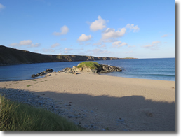
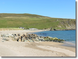
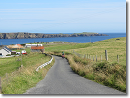
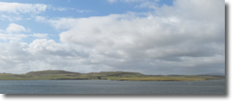
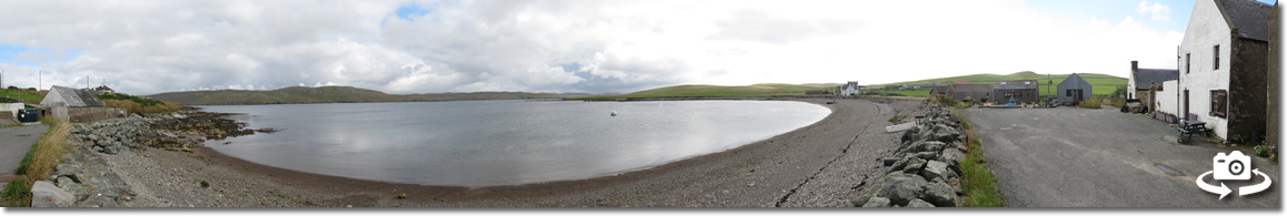
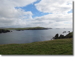
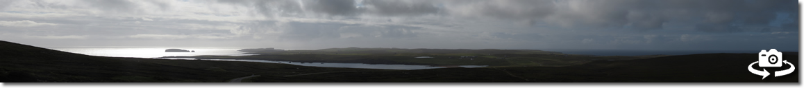
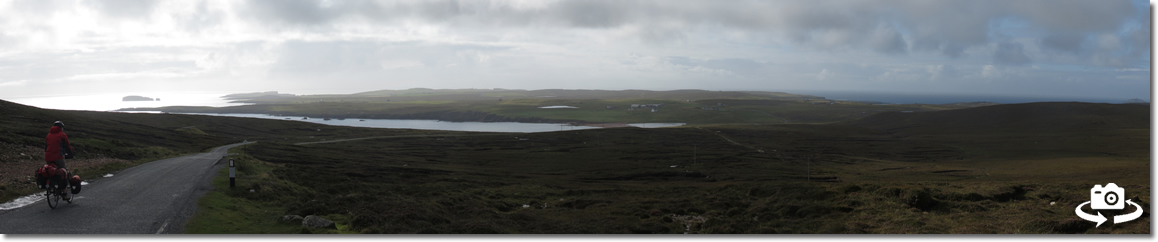
Fortunately the road to Braewick turned West which gave a much better ride. On our way to Hillwick there was a good descent a Urafirth and as we both turned the corner at the bottom and looked back at it we both thought that was good fun but it is going to be a sod to climb on the way back! We knew that there was a shop at Hillswick so we took the diversion to stock up for our stay at Braewick. Hillswick is a canny little place which used to be a small fishing station, they still had the cutch pots where they would boil up the cutch to waterproof the boats sails and rigging to stop them rotting in the sea air. The public toilets were fun as they had decorated the front with a garden with a mermaid figure as the centerpiece. From Hillswick the road was single track with passing places. Generally the car drivers had been very considerate, however one Ford fiesta driver was impatient and forced his way past Frank only inches away from her rear panniers. These drivers have no idea that a small wobble or being caught by the wind and they would have you off. There were several hills to climb over with some cracking views of St. Magnus's bay but we made it to Braewick campsite with out further incident with impatient drivers. The cafe was still open so we treated ourselves to a pot of tea and a lovely piece of home made sponge cake. It was great to sit in some nice comfy seats looking out of the big bay window to a lovely view of Braewick bay.
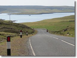
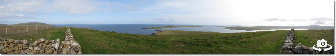
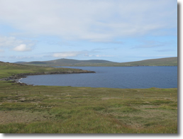
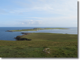
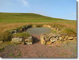
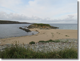
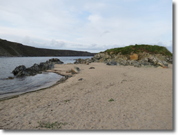
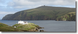
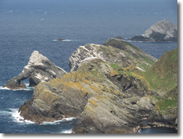
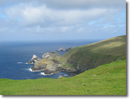
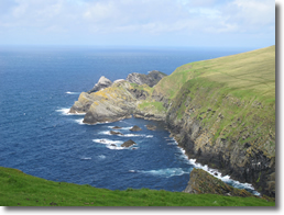
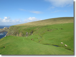
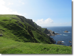
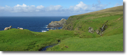
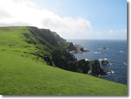
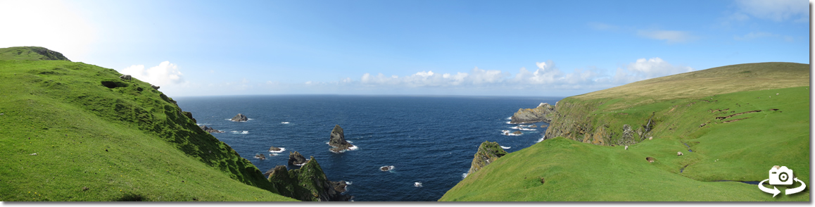
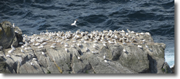
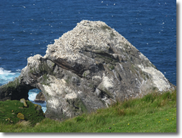
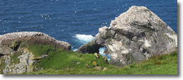
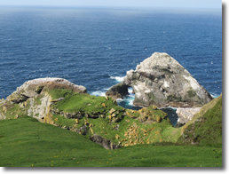
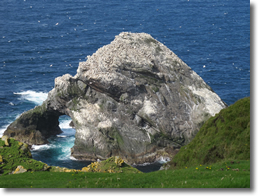
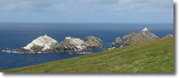
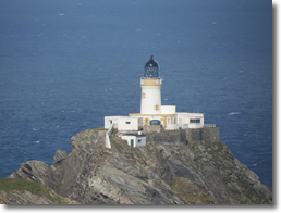
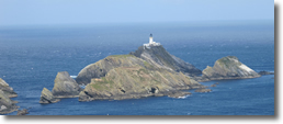
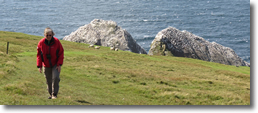
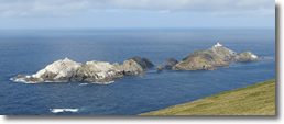
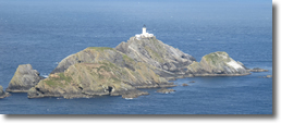
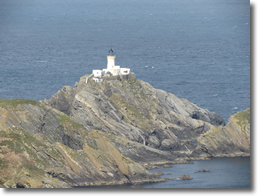
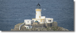
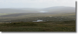
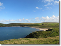
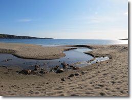
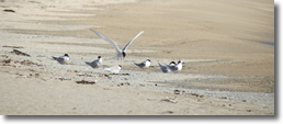
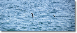
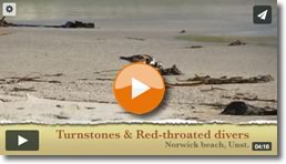
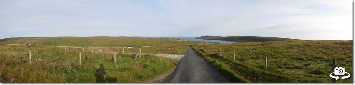
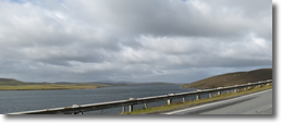
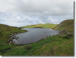
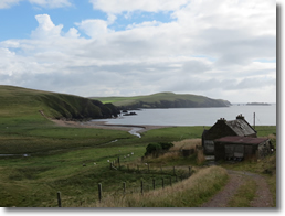
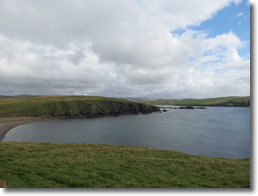
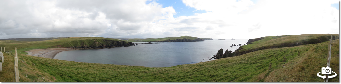
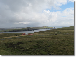
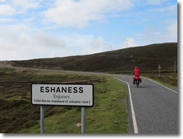
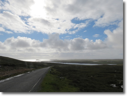
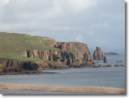
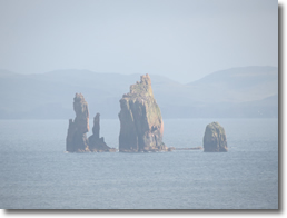
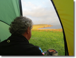
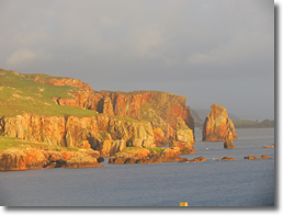
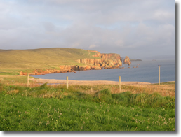
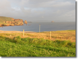
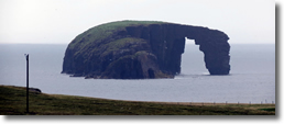
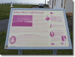
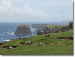
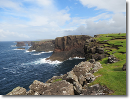
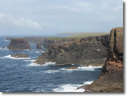
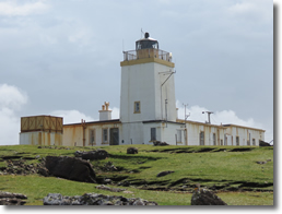
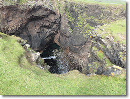
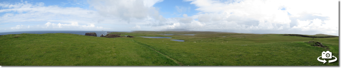
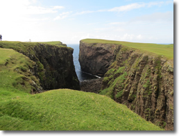
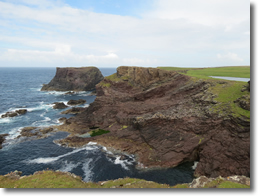
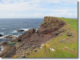
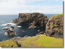
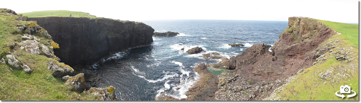
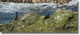
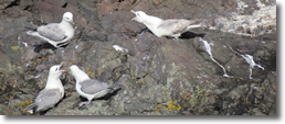
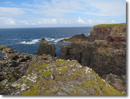
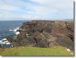
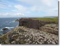
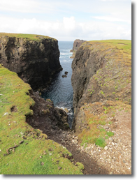
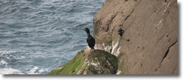
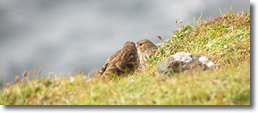
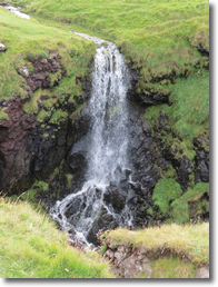
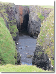
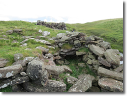
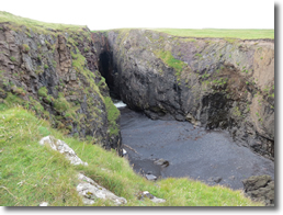
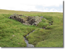
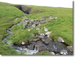
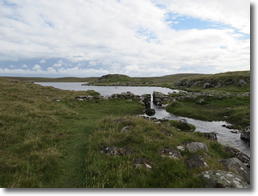
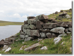
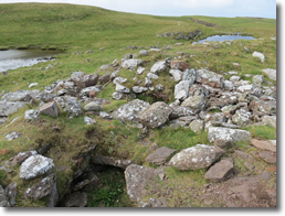
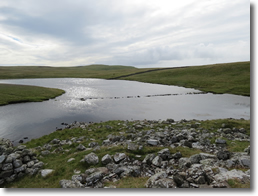
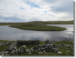
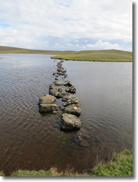
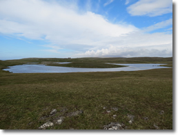
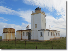
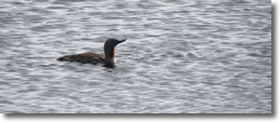
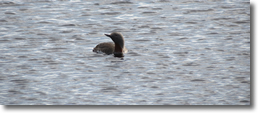
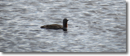
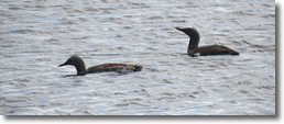
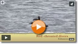
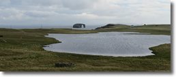
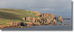
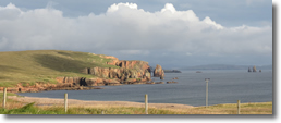
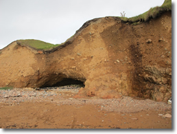
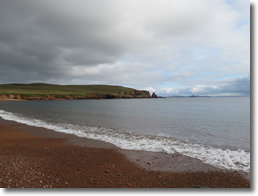
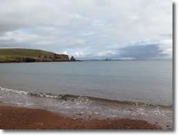
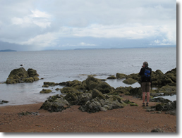
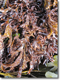
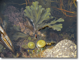
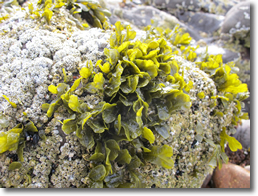
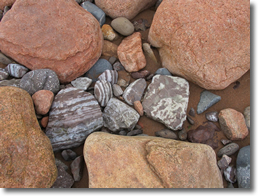
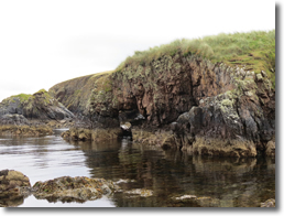
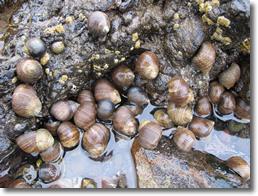
We woke to a nice sunny morning, the wind was a little keen but out of the wind it was warm. We decided to cycle over to Esthaness to have a look at the lighthouse and the cliffs. As it was so nice we just put waterproof jackets in the rucksack, however as I cycled out of the campsite I looked at the distant clouds and they had an ominous look so did a quick about turn and went back to the tent and grabbed the rest of our waterproof gear. I'm glad I did as we had only got about a mile up the road when we were hit by a long heavy shower. We stopped to pick up a cache near to the view point looking across to Dore Holm a small rocky island that had an arch in one end which made it live up to its name as the drinking horse. I noticed a pair of Red-throated Divers on the Loch below us a they called out there Loon like call before swimming off to the other side of the Loch. From the main road there was initially a short but steep hill to climb but the last bit to the lighthouse was quite gentle. The lighthouse is another of the Stevensons builds, this time the tower was square and quite squat. The lighthouse is now automatic and the buildings are currently owned by the Shetland Amenities trust. Unlike the Sumburgh lighthouse this could really do with the new coat of paint as it was really looking quite tatty. We left the bikes at the lighthouse and took the coastal path north to look at the cliffs and the Geos which were quite spectacular as they are of Andesite and Basalt being the result of volcanic activity several million years ago and they rather reminded us of Iceland. We returned via the path that took us past a few blowholes known as the Holes of Scraada and the three old water mills whose stream was feed by the Loch of Houlland above. On the Loch there was a small spit of land sticking out into it which contained the remains of a broch. Close by was a small island in the loch and there was an obvious causeway built to it. We speculated that there was probably an ancient settlement on it as it was very similar to one we had seen in Orkney. On getting back to the lighthouse we walked south along the cliff to see the blow hole. It wasn't so much a hole as a narrow slot or shoot that waves obviously rushed up as we could see all the pebbles that had been thrown up. There was supposed to have been another one further on but my left heel by now was hurting so we turned back. On our way back to the campsite we passed the loch and I noticed that the Red-throated Divers were still there but close to our shore. By a bit of stealth and keeping myself low against the hill I managed to get reasonably close to them and got a good view.
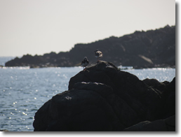
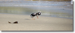
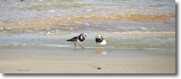
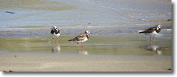
14.08.14 - Braewick After all the exertions of the last couple of weeks Frank was feeling quite tired and her back needed a bit of a rest so we spent most of the day reading and writing postcards. 15.08.14 - Braewick Frank was still not so good and didn't feel that her back would cope with any cycling that day so we decided to stay at Braewick for another night. frank had picked up a little in the afternoon and we had a nice walk down to Braewick Bay where we studied the geology and spent time searching the rock pools and bird watching.
| |||||||||||||||||||||||||||||||||||||||||||||||||||||||||||||||||||||||||||||||||||||||||||||||||||||||||||||||||||||||||||||||||||||||||||||||||||||||||||||||||||||||||||||||||||||||||||||||||||||||||||||||||||||||||||||||||||||||||||||||||||||||||||||||||||||||||||||||||||||||||||||||||||||||||||||||||||||||||||||||||||||||||||||||||||||||||||||||||||||||||||||||||||||||||||||||||||||||||||||||||||||