


 The Celtic Cycling Circle
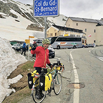 Cycling alongside the Grand Union Canal
 5 Essential Items to Take with You on Your First Cycling Tour
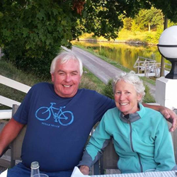 Favorite Cycling Destinations: Sardinia
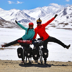 Pamir to Karakoram- cycling the highways on the roof of the world
 4 Wheels 2 Hearts 1 World - A Day in Our lives
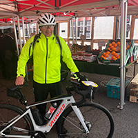
 Koga E-Worldtraveller - e-bike review
 Ten tips for tandem cycle touring
 colmandsamstreks - Two Beginners in France
Electronic Mapping
 Ever since I started hiking in the scouts aged 12 I have always used paper maps to navigate by and I have always thoroughly enjoy pouring over paper maps and find them fascinating. If I ever went anywhere new the first thing I would do would be would be to buy a map of the area. Consequently I have a large collection of paper maps from all over the world and I still remember on our trip in 1995 to West Papua taking paper maps with us that still had large areas saying 'Relief Data incomplete'.
Mapping has moved on considerably since those days with the advent of satellite mapping and the development of GPS navigation systems I doubt that there are any areas left in the world that don't have some sort of accurate mapping. Like everything else these days mapping is now a very much an electronic affair with the introduction of tablets, smartphones and global positioning systems. Having now owned a GPS with the of the UK OS 1:50,000 maps on it I very rarely actually buy a paper map anymore knowing that if I go anywhere in the UK I have a map with me. Similarly owning a smartphone with a large micro SD card installed and the with wonderful OpenStreetMap map system I can download detailed maps for a country before I even get there.
Cycle touring using Electronic Mapping
For the first time on our tour to the Shetland Islands in 2014 we didn't take any paper maps with us and relied solely on the OS 1:50,000 maps that came with our GPSs and the electronic maps that we had stored offline on our smartphones. We had no problem navigating and working out our route so on our recent tour in Norway in 2015 we decided to use both electronic maps and our GPS again to do all the navigation from on our trip and we didn't once revert to using a paper map at all. I must confess that I did have a 1:400,000 scale paper map of Southern Norway in the bottom of my pannier as a back up just in case we ran out of battery power, although it was never used. So it is perfectly feasible to use just electronic mapping for navigating by whilst cycletouring.
So what are the Advantages and Disadvantages of electronic maps
We are assuming that the electronic maps are being used on a GPS or GPS enabled smartphone
Advantages of electronic maps
- The GPS/Smartphone shows you where you are at all times, with an on screen map of where you are.
- Your route can be programmed in and the GPS can navigate for you.
- Easy street by street navigation in cities and towns complete with street names.
- Ability to zoom in and out of scales.
- No need to keep changing the map over.
- No need to keep buying maps as you move areas.
- In mountainous areas it is useful to know you current altitude on a climb.
- You can add 'way marks' so that you can have a record of where you went.
- A GPS will give you an accurate calculation of your distance travelled and the height climbed if you are cycling in mountainous areas.
- Maps can be downloaded for offline use so there is no need to worry about a signal or data use.
- POI (Points of Interest) can be downloaded from many sites now and loaded into the mapping apps to give you more information. For example our own Norwegian Tunnels and Shetland POI files can be down loaded and installed.
Disadvantages of electronic maps
- A GPS/Smartphone uses batteries, you will need recharge these on a regular basis and then you have the added weight of carrying a charger and charging them up at camp sites, not so easy if you are wild camping.
- Initial cost of the GPS/Smartphone and electronic maps against the cost of paper maps. Although the OpenStreetMap maps are free to download and for most of the European countries the detail is very good.
- Some electronic mapping is not as detailed as some paper maps and may not always contains small cycle-able tracks, cycle routes or cycle path information.
- Not all countries are electronically mapped and base maps may not contain contour information and detail of small side roads and points of interest information.
Advantages of paper maps
- When cycling it isn't difficult to navigate if you can read a map, therefore I know where I am at any time and only occasionally have I been 'temporarily unaware of my exact position' !
- Navigating by a paper map is a good mental challenge, a GPS takes all the fun out of it.
- As far as I can see having looked at the electronic maps currently available, a few of them don't include some small cycle-able tracks and information on cycle routes and cycle lanes, which are included on a lot of paper maps.
- Day to day route planning is a lot easier on a paper map than on a GPS or Smartphone with it's small screen.
- You can pencil in the route at the end of the day and mark way marks if you want a record of your route, however some people don't like to mark their maps.
Disadvantages of Paper maps
- You need map reading skills.
- If you are traveling across many countries you will end up with a lot of paper maps which can be quite an expensive and you will then have to carry as extra weight (we have in the past mailed our maps home if we get too many- another expense).
- Paper maps have to bought before you go as sometimes they are not easy to get hold of in the countries you visit unless you are in large towns.
- Paper maps need protection from the elements whilst navigating, however a good map case such as the Ortlieb one can sort that.
- You ave to keep taking the map out of its protective cover and refold it as you cycle along if you are using a small scale detailed map.
- Navigating in large towns or cities can be difficult on large scale maps as no street names are shown, but as my Grandfather always said 'You've got a tongue in your head, well use it!'. We have in the past asked for directions and it's a good way to improve your language skills and meet the locals !
You can make up your own mind as to whether to use electronic mapping or paper mapping but as we mentioned earlier we have used it on a couple of tours and the advantages to us out way the disadvantages.
 So what do we use?
We currently use two GPSs, a Garmin GPSmap 62s and a Garmin Oregon 650. Two GPSs might seem like overkill but the reason is quite simple. Originally I had the map and I used to do all the navigation, however it did frustrate Frank that she didn't know where she was at times and that she was just following me. She was also worried that if anything happened to me like an accident and if she hadn't been keeping an eye on the map she might not know exactly where she was. It would have been a bit silly and expensive to have bought two sets of maps every time we went anywhere and we would have also been laden with the weight of the two sets of maps.
It seemed obvious for us both to have a GPS each. As both GPSs have micro SD cards it is so easy to copy the electronic maps on to each GPS so that we could follow the same map. Frank certainly finds this a lot better as she knows exactly where she is at anytime and she can do her turn of the navigating.
It does mean that we do have two sets of GPS batteries to charge up. Both units have a battery life of approximately 16hours so we can get about 3 days of use before we have to charge them, however with the charging system we carry and the e-werk dynamo charging system on both bikes we haven’t found this to be a problem even when wild camping for several nights. Both units can run directly off the e-werk dynamo systems on our bikes if the batteries run out.
Both units have good clear screens that are easy to read even in bright sunlight and it is easy to zoom in and out on the maps, the Oregon 650 is probably to easiest to use with its touch screen. There is a cycle mount available for both units so they are easily mounted on the handle bars of our bikes.
We don't plan our routes in advance so we don't use any mapping software to pre-plan our routes and upload them to our GPSs like some cyclist do. If you want information on how pre-plan your routes and upload them to your GPS then have a look at Mark of the 'End to End on Two Wheels site has used a GPS on various tours and has some good information on preparing gpx route files here.
GPS Maps
Both our GPSs came bundled with the full UK OS 1:50,000 maps from the Ordnance Survey which to be honest is the cheapest way to buy the maps. If we are touring on the continent the best maps we have used for our Garmin GPSs are the open source based OpenStreetMap maps which are a available on various sites for free (see download links below). These maps are generally very accurate, very detailed and contain a lot of information with points of interest marked, however occasionally we have found some of the small cycle-able tracks missing as we found on a recent trip to Norway. However being OpenStreetMap maps users are able to update these maps online or by using a downloadable piece of editing software using their GPS gpx tracks as a guide. We encourage anyone who uses these free OpenStreetMap maps to give something back by adding any missing information. You can find more information on how to do this on the OpenStreetMap Wiki pages. The great thing about these OpenStreetMap maps is that they are being constantly being updated and you can continually download updated maps!
The Norway map we used for our last Norway trip was downloaded from www.frikart.no. The map came out at just under 1Gb of data so it was easily copied to a fit on a 4Gb Micro SD memory card. Maps for other countries might be significantly bigger.
You can see below some of the screen-shots from the GPSmap 62s of the OpenStreetMap maps we downloaded from www.frikart.no taken at various zoom levels.
 80m |
 200m |
 300m |
 500m |
 1200m |
You can see that they are quite clear maps with very good detail, it is only when you get to 200m that the POI information is shown but this can be adjusted in the GPS settings. The contours are shown well at lower levels however as the scale gets larger they do merge in together but the main roads do show up well.
You can download maps for your GPS from the following sites:
- OSM Map On Garmin
- talkytoaster.co.uk
- frikart.no- The site is in Norwegian but Google translate does a good job.
- garmin.openstreetmap.nl
- mapas.alternativaslibres.es
- gpsmapsearch.com/
 Installing Maps
Downloaded maps can be easily installed on to a GPS. The best way is on to a micro SD card if you GPS supports them, that way you can easily change the maps for different countries. Most maps when downloaded will be initially in a compressed format such as a .zip file and will need to be uncompressed first. If you have downloaded a file for a Garmin GPS you should see in the uncompressed folder a file with the name something like 'gmapsupp.img'. You will need to make a folder called 'Garmin' on the micro SD card and copy the '.img' file to that folder. Once the file is copied place the micro SD card in your GPS and fire it up. If the map doesn't show up check that it is enabled using the 'Setup Map' menu.
Smartphones
 The other thing we take with us are two smartphones that run the android operating system, there are some very good mapping apps that you can install on to them that are useful for touring. Some of these mapping apps use online maps that you need a data connection to load and some have offline maps that you can download and used without need for a data connection. These offline maps like the GPS maps are mostly based on the open source OpenStreetMap maps. Some of the mapping apps have their own maps that you can download for a small fee.
We don't use the smartphones for navigation as the batteries would only last a days cycling if we were lucky and we wouldn't then be able use them in the evenings as we would need to charge them then. We just use the mapping apps to help plan our route as the screen on my Galaxy Note 3 is nice and big and you can pinch and zoom quite quickly with gestures, much easier to do than on the small screens of the GPSs.
![]() There are several mapping apps available for android phones and we have tried several but the one app that we have found to be the best and easiest to use is 'Locus Pro'. The app uses online maps but has the ability to use downloaded maps that you can use offline and you can switch between maps very quickly and easily. With Locus Pro you can download cycling themes or styles which can be used to adjust the look of the map so for example cycle routes and cycle paths show up on the map. Routes created on mapping software can easily be imported as gpx files and you can easily hide or show individual route files when needed. The other thing that we like is the ability to add POI files so that you can see points of interest icons as you move about the map. One of the most useful POI files that we have loaded on to Locus Pro is the Archie's campsites POI which give details and positions of all the European campsites.
There are several mapping apps available for android phones and we have tried several but the one app that we have found to be the best and easiest to use is 'Locus Pro'. The app uses online maps but has the ability to use downloaded maps that you can use offline and you can switch between maps very quickly and easily. With Locus Pro you can download cycling themes or styles which can be used to adjust the look of the map so for example cycle routes and cycle paths show up on the map. Routes created on mapping software can easily be imported as gpx files and you can easily hide or show individual route files when needed. The other thing that we like is the ability to add POI files so that you can see points of interest icons as you move about the map. One of the most useful POI files that we have loaded on to Locus Pro is the Archie's campsites POI which give details and positions of all the European campsites.
Smartphone Maps
Like the GPSs you can download OpenStreetMaps based maps for Locus Pro and other mapping apps. You can download free maps from the following locations:
The openandromaps.org site has some very useful information on how to install the maps and also downloads for the themes. As these map files can be quite big they can take up a lot of memory on your phone. Therefore if you phone has an external micro SD card slot then it is worth investing in a large size micro SD card and transferring the maps in to a folder on that card. You should find a setting in most mapping apps to set the default path to the offline maps folder.
There is a page on openandromaps here which explains how to install openandromapsdirectly into Locus Map Pro.
Set out below are some screen-shots from the Locus Pro maps at various zoom levels and showing different detail.

The OpenStreetMap showing at 3km 100%. |
 The same OpenStreetMap showing at 700m detail. |
 The same OpenStreetMap showing at 80m detail. |
 Map showing the Archies campsites POI and our own Norwegian Tunnel map POIs. |
Clicking on one of the maps above will open a larger version in a new window.